


Underwater mapping 2025 - Part B


Click on the
octopus to return to
the top of the page


01 - Ship trajectory prediction via a transformer-based model by
considering spatial-temporal dependency
Authors: Xinqiang Chen, Peiyang Wu, Yuzhen Wu, Loay
Aboud, Octavian Postolache, Zichuang Wang
The article discusses the increasing importance of ship
trajectory prediction in global maritime trade, emphasizing
the challenges posed by environmental complexities,
multi-factor influences, and data quality issues in
Automatic Identification System (AIS) data. It presents a
novel ship trajectory prediction model based on the
Crossformer architecture, which incorporates innovative
components like Dimension-Segment-Wise embedding
and a Hierarchical Encoder-Decoder structure. The
model’s effectiveness is validated through experiments on
public AIS datasets, showcasing its superior performance
against traditional models.

06 - Submarine Topography Classification Using ConDenseNet with
Label Smoothing Regularization
Authors: Jingyan Zhang, Kongwen Zhang, and Jiangtao
Liu
This article discusses the necessity of classifying submarine
topography and geomorphology for various applications
in marine resource exploitation and ocean engineering. It
critiques traditional visual interpretation methods for their
inefficiency and subjectivity while highlighting the
challenges faced by current machine learning models
when integrating multi-source data. The authors propose
a new model, utilizing pruning-enhanced ConDenseNet
with label smoothing regularization, which significantly
improves classification accuracy and reduces
computational complexity compared to leading models.

09 - Multi-Branch Towed Array System: Systematic Analysis of
Modeling Methods, Environmental Responses and Mechanical
Properties in Fracture Analysis
Authors: Jin Yan, Kefan Yang, Shengqing Zeng, Keqi Yang,
Dapeng Zhang, and Keqiang Zhu
The article discusses the critical role of multi-branch towed
array systems in subsea information collection,
emphasizing their significance in offshore construction
and pipeline laying. It highlights the difficulties faced by
these systems due to complex underwater conditions,
including the risk of cable collisions and torsion
interactions. Such challenges can lead to damaged
towing systems and alterations in their formation, which
are influenced by the specific sea state. The paper also
draws a comparison between these towing systems and
trawl nets to better understand their mechanical
responses post-damage.
12 - Online Multi-AUV Trajectory Planning for Underwater Sweep
Video Sensing in Unknown and Uneven Seafloor Environments
Authors: Talal S. Almuzaini, and Andrey V. Savkin
This article discusses advancements in the navigation of
Autonomous Underwater Vehicles (AUVs) for effective
underwater sensing and monitoring. It presents a novel
algorithm that tackles the challenges posed by uneven
seafloor terrains and visibility constraints due to occlusions
and camera limitations. The solution incorporates a
trajectory planning algorithm that enhances coverage
objectives while adhering to kinematic and safety
constraints. The effectiveness of the proposed approach is
demonstrated through simulations that show improved
performance compared to traditional strategies.
15 - Adaptive Exposure Optimization for Underwater Optical Camera
Communication via Multimodal Feature Learning and Real-to-
Sim Channel Emulation
Authors: Jiongnan Lou, Xun Zhang, Haifei Shen, Yiqian
Qian, Zhan Wang, Hongda Chen, Zefeng
Wang, and Lianxin Hu
Underwater Optical Camera Communication (UOCC) is a
new method for secure data exchange in autonomous
underwater vehicles. Its effectiveness relies on exposure
time and International Standards Organization (ISO)
sensitivity, affected by underwater conditions. Traditional
systems struggle with changing conditions. A new
framework combines imaging, environmental data, and a
model for better prediction accuracy and real-time
adaptation. This results in improved signal quality and
potential for practical underwater communication use
cases.

13 - Geostatistical uncertainty maps for real-world efficient AUV data
collection
Authors: Ana F. Duarte, Lucrezia Bernacchi, Renato
Mendes, João Borges de Sousa, and Leonardo
Azevedo
The article discusses a geostatistical modeling workflow
designed to enhance the trajectory planning of
Autonomous Underwater Vehicles (AUVs) for
oceanographic surveys. It centers on two main objectives:
predicting ocean temperature and spatial uncertainty,
which informs optimized navigation paths, and facilitating
the efficient assimilation of collected data into ocean
models. An illustrative case study conducted off the coast
of Western Portugal demonstrates the workflow’s efficacy,
revealing improved data prediction capabilities and model
reliability.
14 - RECAD: Retinex-Based Efficient Channel Attention with Dark
Area Detection for Underwater Images Enhancement
Authors: Tianchi Zhang, Qiang Liu, Hongwei Qin, and
Xing Liu
The article focuses on improving visual target detection for
Autonomous Underwater Vehicles (AUVs) by proposing a
new image enhancement method named RECAD. This
method addresses common problems found in weakly
illuminated underwater images, such as blurring and
color distortion. While existing deep learning methods
struggle with feature extraction and high computational
costs, RECAD utilizes Retinex theory and incorporates
mechanisms for dark region detection and channel
attention to enhance performance. Extensive testing
shows that RECAD significantly outperforms existing
models.
16 - Next-generation underwater localization: Artificial Intelligence-
based and energy-aware approaches
Authors: Mainul Islam Chowdhury, Quoc Viet Phung,
Iftekhar Ahmed, Walid K.Hasan, Daryoush Habibi
This study highlights the problems associated with large
propagation delays, the lack of GPS, node mobility, and
limited acoustic link capacity that complicate underwater
monitoring applications. Traditional localization methods’
limitations are discussed, particularly their sensitivity to
noise and communication constraints. The article also
emphasizes the importance of energy efficiency due to
difficulties in replacing and recharging batteries in
underwater environments. It provides a comprehensive
review of how artificial intelligence (AI), including deep
learning and machine learning, can enhance localization
accuracy and robustness while integrating energy-saving
strategies.
17 - A classification method of underwater target radiated noise
signals based on enhanced images and convolutional neural
networks
Authors: Yuan Muye, Lei Zhufeng, Dang Yinuo, and Shi
Zanrong
The article discusses the challenges of identifying
underwater vehicles due to advancements in technology
and the inadequacy of traditional classification methods
based on signal characteristics. It presents a novel
approach using multiple convolutional neural network
(CNN) recognition methods enhanced by Gramian
Angular Field (GAF) images. The paper details the process
of converting underwater target noise signals into GAF
images, which are then utilized to train various CNN
models. The results indicate that the VGG-16 model
demonstrated superior classification accuracy of 80.67%.
18 - RG-SAPF: A Scheme for Cooperative Escorting of Underwater
Moving Target by Multi-AUV Formation Systems Based on
Rigidity Graph and Safe Artificial Potential Field
Authors: Wen Pang, Daqi Zhu, Mingzhi Chen, & Wentao
Xu
This paper discusses how to escort a moving underwater
target, like a human-occupied vehicle, using multiple
autonomous underwater vehicles (AUVs) in difficult
ocean settings. It introduces the “Reward-Guided State-
Action Prediction and Filtering (RG-SAPF)” scheme for
formation control and path planning, ensuring effective
target escorting in complex environments.

02 - Underwater Digital Twin of Yuba Island: Mapping a Large-Scale
Marine Ecosystem through Photogrammetry and 3D Modeling
- Published by the International Journal on Advanced Science Engineering Information
Technology
Author: Christoph Gerigk
The project described in this paper aimed to construct a
detailed digital twin of the underwater environment
surrounding Yuba Island in the Red Sea, Saudi Arabia,
mimicking the diving experience through precise 3D
mapping of both underwater and above-water
landscapes. Completed in six months, the model includes
accurately rendered textures and colors, with a depth
accuracy of ±0.10 m. It encompasses a diverse marine
ecosystem, documenting over 100 local fish species, and
culminates in various digital deliverables, including VR
experiences and software applications.

03 - Underwater Mapping in Shallow Coastal Waters Using MBES
and Photogrammetry: Applications in Archaeology and Marine
Habitat Monitoring
- Published by the International Journal on Advanced Science Engineering Information
Technology
Authors: Saso Poglajen, & Mojca Poklar
This study investigates the synergistic use of Multibeam
Echosounder (MBES) and Structure-from-Motion (SfM)
photogrammetry to enhance underwater mapping in
shallow coastal environments, particularly within
Slovenian waters. The research includes two case studies:
mapping Posidonia oceanica seagrass meadows and
analyzing the submerged archaeological site of Fizine.
The integration of MBES’s spatial precision with the visual
detail provided by SfM improves habitat classification and
documentation of underwater features by capturing both
broad structures and intricate details.


04 - Application and Challenges of Photogrammetry in Underwater
Excavations: Case Studies from the Jeju Sinchang-ri and Gunsan
Seonyudo Sites, Korea
Author: Jeong Heon
Photogrammetry is increasingly used but faces challenges
in underwater contexts due to strong currents and low
visibility. This study compares its application at two Korean
sites: Jeju Sinchang-ri—where clear water enabled high-
resolution mapping using a Double Grid method and
Metashape, yielding 3D models, orthophotos, and artifact
distribution maps—and Gunsan Seonyudo—where thick
sediment and poor visibility necessitated experimental
adaptations like tide-timed surveys and underwater
lighting to produce trench plans and stratigraphic cross-
sections distinguishing artifact-bearing layers. The findings
underscore the need to tailor photogrammetric methods
to local underwater conditions, supporting more effective
documentation as shipwreck discoveries increase.
05 - Sensor Synergy in Bathymetric Mapping: Integrating Optical,
LiDAR, and Echosounder Data Using Machine Learning
Authors: Emre Gülher, and Ugur Alganci
This study integrates multi-sensor datasets to improve
bathymetric mapping in coastal and inland waters,
leveraging sensor strengths via data fusion and machine
learning for better spatial coverage, resolution, and
accuracy.


07 - Deformable USV and Lightweight ROV Collaboration for
Underwater Object Detection in Complex Harbor Environments:
From Acoustic Survey to Optical Verification
Authors: Yonghang Li, Mingming Wen, Peng Wan, Zelin
Mu, Dongqiang Wu, Jiale Chen, Haoyi Zhou, Shi
Zhang, and Huiqiang Yao
This study proposes a collaborative system integrating a
deformable unmanned surface vehicle (USV) with a
lightweight remotely operated vehicle (ROV). The USV,
equipped with side-scan sonar (SSS) and multi-beam echo
sounder (MBES), enables rapid large-area seabed
mapping and object localization, while the ROV, with
optical cameras, forward-looking sonar (FLS), and a
manipulator, confirms and disposes of identified objects.
Field trials in the South China Sea demonstrated the
system's effectiveness.
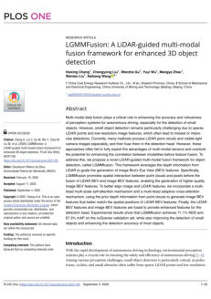
08 - LGMMFusion: A LiDAR-guided multi-modal fusion framework for
enhanced 3D object detection
Authors: Haixing Cheng, Chengyong Liu, Wenzhe Gu,
Yuyi Wu, Mengye Zhao, Wentao Liu, Naibang
Wang
LGMMfusion is a novel LiDAR-guided multimodal fusion
framework for autonomous driving object detection,
designed to improve small-object detection by addressing
limitations of sparse LiDAR points and low-resolution
image features. Unlike conventional methods that fuse
LiDAR and camera features only at the detection head,
LGMMfusion leverages LiDAR depth priors to guide the
generation of higher-quality image Bird’s Eye View (BEV)
features before fusion. It enables early spatial interaction
between point clouds and pixels via multi-head, multi-
scale self-attention and adaptive cross-attention
mechanisms, thereby ensuring better alignment
10 - Detection of Submerged Targets Beyond Eyes' Observation
Using Satellite LiDAR and Multispectral Data
Authors: Hao Liu, Jian Yang, Yue Ma, Yao Li, and Xiao Hua
Wang
Underwater image quality is degraded by light absorption
and scattering, hindering applications in marine robotics
and archaeology. Existing enhancement methods often
fail to recover fine details without artifacts. This work
proposes a hybrid U-Net-Transformer (UTR) architecture
that combines local feature extraction with global context
modeling. Its key innovation is the Recurrent Multi-Scale
Feature Modulation (R-MSFM) mechanism, a gated, multi-
scale iterative refinement strategy in the decoder that
preserves spatial fidelity during upsampling.
11 - Underwater Image Enhancement with a Hybrid U-Net-
Transformer and Recurrent Multi-Scale Modulation-
Authors: Zaiming Geng, Jiabin Huang, Xiaotian Wang, Yu
Zhang, Xinnan Fan, and Pengfei Shi
This research introduces a novel underwater image
enhancement framework for autonomous underwater
vehicles (AUVs) to improve marine ecosystem observation
and conservation. The proposed method combines a
Denoising Diffusion Probabilistic Model (DDPM) for image
restoration with an Attention-Enhanced Convolutional
Blocks (AECB) augmented Transformer backbone. AECB
modules use dual channel and spatial attention to boost
visual quality. The framework is designed to be
computationally efficient for onboard AUV deployment.
Experiments show it outperforms existing transformer-
diffusion methods, with the dual attention mechanism
significantly improving image clarity and detail.

19 - DM-AECB: a diffusion and attention-enhanced convolutional
block for underwater image restoration in autonomous marine
systems
Authors: Naveen Kumar Tiwari, Abhishek Bajpai, Shashank
Yadav, Anas Bilal, Abdulbasit A. Darem, Raheem
Sarwar, and Jaibir Singh This paper discus
This study presents a novel underwater image
enhancement framework combining a Denoising
Diffusion Probabilistic Model (DDPM) with Attention-
Enhanced Convolutional Blocks (AECB) and a Transformer
backbone for biodiversity monitoring and habitat
mapping. The AECB modules employ dual channel and
spatial attention mechanisms to enhance image quality,
while a lightweight architecture with skip-sampling
optimization enables efficient deployment on AUVs and
underwater drones.
20 - Explainable underwater target recognition models: principles,
methods, and applications
Authors: Tianyang Xu, Hongjian Jia, and Jixing Qin
This paper systematically reviews explainable models for
underwater target recognition, covering core concepts,
methods, and research progress in sonar imaging, signal
analysis, and autonomous navigation. It highlights future
directions, such as causal reasoning, cross-modal
collaboration, and physical knowledge integration, to
guide the development of safe and reliable underwater
intelligent systems.

21 - Applying Deep Learning to Bathymetric LiDAR Point Cloud
Data for Classifying Submerged Environments
Authors: Nabila Tabassum, Henri Giudici, Vimala
Nunavath, and Ivar Oveland
Subsea environments are crucial for biodiversity, climate
regulation, and human activities like fishing and resource
extraction, necessitating accurate mapping for sustainable
management. Airborne LiDAR bathymetry (ALB) offers
high-resolution underwater data but generates large,
complex datasets that challenge efficient analysis. This
study applies deep learning models, Long Short-Term
Memory (LSTM) and Bidirectional LSTM (BiLSTM), to multi-
class classification of ALB waveform data. A preprocessing
pipeline extracted and labeled waveform peaks into five
classes: sea surface, water, vegetation, seabed, and noise.
Experiments on two datasets showed high classification
accuracy:
22 - A Fourier Neural Operator-enhanced parabolic equation
framework for highly efficient underwater acoustic field
prediction
Authors: Xinshuo Zheng, Haofeng Xia, Hanzhuo Wang,
Chi Zhang, Jiaxi Duan, Jingyi Liu and Shuai Tang
This work proposes an efficient solution method for the
parabolic equation model based on the Fourier Neural
Operator, which leverages grid-independent O(n log n)
spectral convolution for rapid global feature extraction
and robust correlations between physical field parameters
and sound pressure fields. The model incorporates a
continuous mapping that allows self-adjustment and
adaptability to diverse marine scenarios, including non-
uniform sound speed profiles, broadband sources, and
sloped bathymetry.
23 - Mapping River Bed Topography in Whitewater Rapids
Using Bathymetric LiDAR
Authors: Jan Rhomberg-Kauer, Theresa Himmelsbach,
Florian Pöppl, Lucas Dammert,
Martin Pfennigbauer, Gottfried Mandlburger
Bathymetric LiDAR struggles to detect riverbeds in
turbulent whitewater rapids of mountain rivers. This study
introduces a novel full-waveform processing method that
uses curve fitting to model and subtract the water column
signal, isolates residual energy, and applies peak detection
to recover previously undetected bottom returns.
Validated across three rivers using total station ground
truthing, the method reduces median vertical errors from
20.6 cm to 9.2 cm and from 40.4 cm to 22.5 cm,
significantly filling data gaps in whitewater zones.
24 - A Review of Solid-State LiDAR Principles and Metasurface-Based
LiDAR Sensors
Authors: Elif Demirbas, Braden Boucher, Matthew Baker,
Joshua Andrews, William Cruz, Sara Mueller, and
Samuel Serna-Otalvaro
LiDAR is a promising technology for autonomous vehicles,
with solid-state alternatives like microelectromechanical
systems (MEMS) and optical phased arrays (OPAs) offering
compact and robust solutions compared to traditional
mechanical LiDAR systems with rotating mirrors. Two-
dimensional optical metasurfaces enable beam steering
by shifting the phase of incoming light; static metasurfaces
are suitable for fixed beam directions, while dynamic
(tunable) metasurfaces are essential for real-time beam
scanning. Metasurface-based LiDAR provides advantages
such as flat optics design, robustness, and absence of
moving parts.
25 - Trajectory tracking control of autonomous underwater vehicles:
a review from classical methods to AI-based approaches
Authors: Aly M. Eissa, Samer A. Mohamed, Mohammed
Ibrahim Awad, Hossam E. Abd El Munim, Diaa
Emad
Autonomous Underwater Vehicles (AUVs) are crucial for
tasks like seabed mapping and search-and-rescue
operations, yet face challenges in trajectory tracking due
to complex dynamics and uncertainties. This review
categorizes tracking control strategies into three groups:
classical controllers like PID; intelligent controllers including
Fuzzy Logic and Reinforcement Learning; and hybrid
approaches like Adaptive Neuro-Fuzzy systems. A meta-
analysis of 120 studies shows performance trends,
emphasizing future research in adaptive fault-tolerant
control and hybrid learning..