Underwater mapping 2025


Click on the
octopus to return to
the top of the page


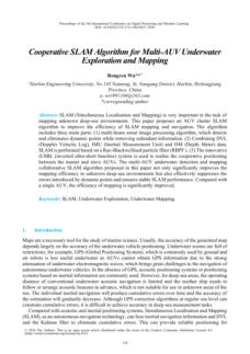
17 - Cooperative SLAM Algorithm for Multi-AUV Underwater
Exploration and Mapping
Author: Rongren Wu
SLAM (Simultaneous Localisation and Mapping) is crucial
for mapping unknown deep-sea areas. This paper
suggests an AUV cluster SLAM algorithm to enhance
mapping efficiency. It has three parts: (1) a multi-beam
sonar image processing algorithm that filters dynamic
points and redundant information; (2) SLAM using data
from DVL, IMU, and DM based on a Rao-Blackwellised
particle filter; and (3) an iUSBL system for cooperative
positioning of AUVs. This algorithm significantly improves
mapping efficiency and stabilizes SLAM performance by
reducing errors from dynamic points.


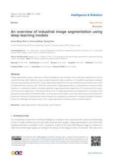
16 - An overview of industrial image segmentation using deep
learning models.
Authors: Guina Wang, Zhen Li, Guirong Weng, Yiyang
Chen
Image segmentation is important in AI and computer
vision, used for tasks like industrial picking and video
surveillance. This review covers traditional and deep
learning segmentation algorithms, including their
integration. It discusses various label frameworks and
compares methods on benchmark datasets. Lastly, it
addresses challenges and opportunities for future
research.


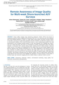
01 - Remote Awareness of Image Quality for Multi-week Shore-
launched AUV Surveys
Authors: Adrian Bodenmann, Daniel O.B. Jones,
Alexander B. Phillips, Robert Templeton, Rashiid
Sherif, Francesco Fanelli, Darryl Newborough,
and Blair Thornton
Visual seafloor imaging using autonomous underwater
vehicles (AUVs) is now a common method for mapping
and monitoring. This research creates a new way to
assess image quality on-site during a 21-day AUV
campaign. AUV operators received quality scores via
satellite to improve data collection.


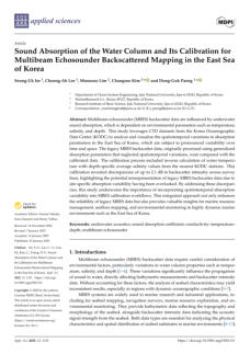
03 - Sound Absorption of the Water Column and Its Calibration for
Multibeam Echosounder Backscattered Mapping in the East Sea
of Korea
Authors: Seung-Uk Im, Cheong-Ah Lee, Moonsoo Lim,
Changsoo Kim, and Dong-Guk Paeng
This study uses Korea Oceanographic Data Center)
datasets to analyze and visualize spatiotemporal variations
in underwater sound absorption in the East Sea of Korea.
The calibration process revealed discrepancies of up to 2.1
dB in backscatter intensity across survey lines, highlighting
potential misrepresentation of legacy Multibeam
echosounder (MBES) data due to site-specific absorption
variability. This integrated approach enhances the
reliability of legacy MBES data and provides valuable
insights for marine resource management and
environmental monitoring.


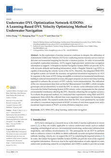
04 - Underwater DVL Optimization Network (UDON): A Learning-
Based DVL Velocity Optimizing Method for Underwater
Navigation

Authors: Feihu Zhang, Shaoping Zhao, Lu Li, and Chun
Cao
This paper proposes an end-to-end deep-learning
approach to improve the accuracy of Doppler Velocity
Log (DVL) velocity vector measurements for autonomous
underwater vehicles (AUVs) that uses raw measurement
data from an Inertial Measurement Unit (IMU) to assist
DVL in velocity vector estimation and refining it towards
the Global Positioning System (GPS). The research results
show that the proposed method can achieve a maximum
improvement of 69.26% in root mean square error and
78.62% in relative trajectory error in DVL vector
predictions.


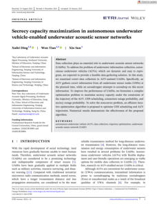
05 - Secrecy capacity maximization in autonomous underwater
vehicle-enabled underwater acoustic sensor networks
Authors: Xufei Ding, Wen Tian, Xin Sun
This study examines covert data collection in autonomous
underwater vehicles (AUVs) for underwater acoustic
sensor networks (UASNs). The researchers propose an
efficient iterative optimization algorithm to optimize USN
scheduling and AUV routes, aiming to maximize secrecy
capacity under constraints such as AUV trajectory, USN
scheduling, connection outage probability, and secrecy
outage probability.



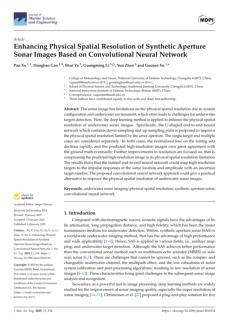
06 - Enhancing Physical Spatial Resolution of Synthetic Aperture
Sonar Images Based on Convolutional Neural Network
Authors: Pan Xu, Dongbao Gao, Shui Yu, Guangming Li,
Yun Zhao, and Guojun Xu
This deep learning method is used to improve the physical
spatial resolution of underwater sonar images using a
proposed U-shaped end-to-end neural network, which
includes down-sampling and up-sampling parts. This
method reduces normalized loss on testing sets and
improves the accuracy of predicted high-resolution
images. This trained network can map high-resolution
targets to impulse responses, providing a practical
alternative for underwater target detection..


07 - Underwater Target Detection with High Accuracy and Speed
Based on YOLOv10
Authors: Zhengliang Hu, Le Cheng, Shui Yu, Pan Xu,
Peng Zhang, Rui Tian, and Jingqi Han
This study presents an underwater target detection
method based on YOLOv10 (You Only Look Once v10),
which outperforms the YOLOv5 model in terms of
detection accuracy and speed. The YOLOv10 model has a
mAP50 (Average Precision at an Intersection over Union
threshold of 50%) of 85.6% on the URPC 2020
(Underwater Robot Picking Contest 2020) dataset, a 1.2%
improvement from YOLOv5, demonstrating its potential
for precise and fast underwater target detection.


08 - Side-Scan Sonar Small Objects Detection Based on Improved
YOLOv11
Authors: Chang Zou, Siquan Yu, Yankai Yu, Haitao Gu,
and Xinlin Xu
The study proposes an improved YOLOv11 (You Only
Look Once v11) network called YOLOv11-SDC for
underwater object detection using side-scan sonar. It
includes a new Sparse Feature module, a Dilated
Reparam Block, a Control Module, and a Content-Guided
Attention Fusion module. The improved method
outperforms previous versions in detection performance.


09 - A Deep Shrinkage Network for Direction-of-Arrival Estimation
with Sparse Prior
Authors: Lei Zhou, Shihong Zhou, Yubo Qi, Lixin Wu,
and Yannick Benezeth
This study proposes a deep learning-based framework for
estimating Direction-of-arrival (DOA) in underwater
multipath signals. It uses sparse representation and a
super-resolution deep shrinkage reconstruction network
(SDSR-Net) to map the sparse representation of the
covariance matrix to the DOA. Simulations and
evaluations show that the proposed method significantly
improves DOA estimation accuracy.


10 - An Improved YOLOv9s Algorithm for Underwater Object
Detection
Authors: Shize Zhou, Long Wang, Zhuoqun Chen, Hao
Zheng, Zhihui Lin, and Li He
The YOLOv9s-SD (You Only Look Once 9s-SD)
underwater target detection algorithm aims to improve
underwater object detection performance by combining
MobileNetV2's (MobileNetV2 is a convolutional neural
network architecture designed for mobile and embedded
vision applications) inverted residual structure with Simple
Attention Module and Squeeze-and-Excitation Attention.
Experiments show improvement in mean Average
Precision, demonstrating better adaptability to intricate
underwater environments.


11 - Advancing Seabed Bedform Mapping in the Kuznica Deep:
Leveraging Multibeam Echosounders and Machine Learning
for Enhanced Underwater Landscape Analysis
Authors: Lukasz Janowski
This study focuses on the development of an automatic
seabed mapping methodology using multibeam
echosounders and machine learning, integrating various
scientific fields to understand the underwater landscape,
addressing sediment composition, backscatter intensity,
and geomorphometric features. It emphasizes using
fewer, carefully selected features for training models,
improving accuracy and robustness.


12 - Real-Time Registration of 3D Underwater Sonar Scans
Authors: António Ferreira, José Almeida, Aníbal Matos,
and Eduardo Silva
This article presents a collection of generic matrix
manipulation kernels for parallelized perception
applications. It discusses a parallel implementation for the
3DupIC algorithm, a probabilistic scan matching method
for sonar scan registration. Tests show the algorithm's
real-time performance, enabling 3D sonar scan matching
to be executed onboard the EVA AUV.


13 - Multi-Scale Feature Enhancement Method for Underwater
Object Detection
Authors: Mengpan Li, Wenhao Liu, Changbin Shao, Bin
Qin, Ali Tian, and Hualong Yu
This paper presents a Multi-Scale Feature Enhancement
(MSFE) method to address challenges in underwater
object detection, aiming to achieve dual multi-scale
information integration through the internal structural
design of the basic C2F module (a module that converts
convolutional outputs into structured features) in the
Backbone network and the external global design of the
feature pyramid network (FPN). The method uses a
module to address fine-grained feature vanishing and
injects a shallow feature branch to enhance information
integration between inter-layer features.


14 - The Method for Storing a Seabed Photo Map of the During
Surveys Conducted by an Autonomous Underwater Vehicle
Authors: Chang Liu, Vladimir Filaretov, Eduard
Mursalimov, Alexander Timoshenko, and
Alexander Zuev
This paper presents a new method for creating a
photographic map of the seabed using images captured
by autonomous underwater vehicles' photo and video
systems, stored in a mosaic format, allowing for automatic
search and recognition of underwater objects. The
authors emphasize the efficiency of the method, which
forms the map directly during the vehicle's movement,
using only the onboard computer's computing power. Its
algorithm for saving the map in mosaic format, used in
interactive geographic maps like Google Maps, reduces
read and write operations, ensuring timely operation.


15 - AUV Online Path Planning Strategy Based on Sectorial Gridded
Detection Area
Authors: Yang Liu, Jinxi Sun, Guojie Li, and Xiujun Xu
This study proposes an online path planning strategy for
an autonomous underwater vehicle using forward-
looking sonar in unknown environments. It divides the
sonar fan-shaped detection area into multiple grids and
uses a comprehensive cost function for optimal heading.
This strategy ensures safe and smooth navigation in
obstructed areas and narrow passages.


20 - Lightweight Underwater Target Detection Algorithm Based on
YOLOv8n
Authors: Dengke Song and Hua Huo
The RDL-YOLO is a lightweight detection algorithm
designed to tackle challenges in underwater target
detection, including complex environments, image
blurring, and high model parameter counts that
incorporates optimizations. Experimental results show an
average precision increase of 1.4% and 1.0%, respectively,
while reducing parameter count and computational
complexity by 19.3% and 14.8%.


21 - Persistent Localization of Autonomous Underwater Vehicles
Using Visual Perception of Artifi cial Landmarks
Authors: Jongdae Jung, Hyun-Taek Choi, and Yeongjun
Lee
This paper proposes a visual landmarks-based
simultaneous localization and mapping (SLAM) system for
autonomous underwater vehicles (AUVs). The system
uses two types of underwater landmarks observed using
forward and downward-looking cameras. The
information, along with incremental DR estimates, is
integrated within the extended Kalman filter (EKF) SLAM
approach.


22 - SDA-Mask R-CNN: An Advanced Seabed Feature Extraction
Network for UUV
Authors: Yao Xiao, Dongchen Dai, Hongjian Wang,
Chengfeng Li, and Shaozheng Song
The paper introduces a novel framework for precise
seabed terrain edge feature extraction from Side-Scan
Sonar (SSS) images, enhancing Unmanned Underwater
Vehicle (UUV) perception and navigation. This framework
addresses challenges in underwater image analysis,
including low segmentation accuracy and ambiguous
edge delineation. It incorporates a Structural Synergistic
Group-Attention Residual Network, a Depth-Weighted
Hierarchical Fusion Network, and an Adaptive Synergistic
Mask Optimization strategy.


23 - A Holistic High-Resolution Remote Sensing Approach for
Mapping Coastal Geomorphology and Marine Habitats
Authors:
Evagoras Evagorou, Thomas Hasiotis, Ivan Theophilos
Petsimeris, Isavela N. Monioudi, Olympos P. Andreadis,
Antonis Chatzipavlis, Demetris Christofi, Josephine
Kountouri, Neophytos Stylianou, Christodoulos Mettas,
Adonis Velegrakis, and Diofantos Hadjimitsis
This research demonstrates how satellite, aerial, terrestrial,
and marine remote sensing techniques can be integrated
to produce accurate information, revealing significant
elevation and shoreline changes over one year,
highlighting coastal zone dynamics. This highlights the
importance of incorporating information from all available
sensors for complete geomorphological and marine
habitat mapping for sustainable coastal management
strategies.


24 - Model-Based AUV Path Planning Using Curriculum Learning
and Deep Reinforcement Learning on a Simplifi ed Electronic
Navigation Chart
Authors: Lukasz Marchel, Rafał Kot, Piotr Szymak, and
Paweł Piskur
This paper evaluates reinforcement learning (RL)-based
methods for autonomous underwater vehicles (AUVs)
trajectory planning. It incorporates a full motion model
and proposes a reward function to elicit desired
behaviors. The models are trained on simplified ENC maps
and compared against five classical methods. The
proposed solution enables efficient, collision-free route
planning.


25 - Depth Estimation of an Underwater Moving Source Based on
the Acoustic Interference Pattern Stream
Authors: Lintai Rong, Bo Lei, Tiantian Gu, and Zhaoyang
He
This study proposes an interference feature fusion (IFF)
method for underwater maneuvering sources in deep
oceans that extracts the principal interference mode of
the VTR and constructs a depth ambiguity function. This
method achieves long-term depth estimation and
recognition of underwater sources without
environmental information. It can suppress false peaks
and reduce depth estimation errors by at least 47%
compared to the generalized Fourier transform method.


26 - Underwater Side-Scan Sonar Target Detection: An Enhanced
YOLOv11 Framework Integrating Attention Mechanisms and a
Bi-Directional Feature Pyramid Network
Authors: Junhui Zhu, Houpu Li, Min Liu, Guojun Zhai,
Shaofeng Bian, Ye Peng, and Lei Liu
Underwater target detection is crucial for marine
exploration, but faces challenges due to the complex
underwater environment. The ABFP-YOLO model
addresses these issues by integrating a bi-directional
feature pyramid network and an attention module. It
effectively recognizes targets of varying scales, especially
small ones, in complex scenarios. Experiments on two
datasets show the model achieves mean average
precision scores of 0.988 and 0.866, indicating superior
performance in complex underwater environments.


27 - Oscillatory Forward-Looking Sonar Based 3D Reconstruction
Method for Autonomous Underwater Vehicle Obstacle
Avoidance
Authors: Hui Zhi, Zhixin Zhou, Haiteng Wu, Zheng Chen,
Shaohua Tian, Yujiong Zhang, and Yongwei
Ruan
This study proposes a cost-effective 3D reconstruction
method for autonomous underwater vehicle inspection in
3D environments that uses an oscillatory forward-looking
sonar with a pan-tilt mechanism, extending perception
from a 2D plane to a 75-degree spatial range. The system
integrates with the Ego-Planner path planning algorithm
and nonlinear Model Predictive Control algorithm,
achieving 100%, 60%, and 30% obstacle avoidance
success rates under localization errors.


28 - Three-Dimensional Localization of Underwater Nodes Using
Airborne Visible Light Beams
Authors: Jaeed Bin Saif, Mohamed Younis, and Fow-Sen
Choa
This paper proposes a novel localization method using
visible light communication (VLC) from an airborne unit to
locate underwater nodes, which uses VLC transmissions
towards the water surface, encoded with GPS
coordinates. Existing techniques assume depth
measurements, but this method uses VLC signals to
estimate the underwater node's 3D position. Extensive
simulations validate the method's effectiveness and
performance across various parameters.


29 - Underwater SLAM Meets Deep Learning: Challenges, Multi-
Sensor Integration, and Future Directions
Authors: Mohamed Heshmat, Lyes Saad Saoud, Muayad
Abujabal, Atif Sultan, Mahmoud Elmezain,
Lakmal Seneviratne, and Irfan Hussain
This survey analyzes the latest developments in deep
learning-enhanced simultaneous localization and
mapping (SLAM) for underwater applications,
categorizing approaches based on methodologies, sensor
dependencies, and integration with deep learning
models, highlighting the benefits and limitations of
existing techniques, key innovations, and unresolved
challenges. It also introduces a novel classification
framework for underwater SLAM based on its integration
with underwater wireless sensor networks (UWSNs),
enhancing localization, mapping, and real-time data
sharing among AUVs.


30 - Underwater-Image Enhancement Based on Maximum
Information-Channel Correction and Edge-Preserving Filtering
Authors: Wei Liu, Jingxuan Xu, Siying He, Yongzhen
Chen, Xinyi Zhang, Hong Shu, and Ping Qi
The authors propose an underwater-image enhancement
(UIE) approach to address issues like color distortion and
reduced contrast in underwater images. They use
maximum information-channel compensation and edge-
preserving filtering techniques to improve color quality.
This approach involves enhancing the color-corrected
image, generating globally contrast-enhanced images,
and decomposing the enhanced image into low-
frequency and high-frequency components.


31 - Task Allocation and Path Planning Method for Unmanned
Underwater Vehicles
Authors: Feng Liu, Wei Xu, Zhiwen Feng, Changdong
Yu, Xiao Liang, Qun Su, and Jian Gao
This study proposes a task allocation and path planning
method for Unmanned Underwater Vehicles (UUVs) to
improve their autonomous navigation and adaptability in
complex marine environments, using an Improved Grey
Wolf Algorithm (IGWA) and a Circle chaotic mapping
strategy to optimize task allocation and search efficiency.
An algorithm termed GR-RRT is employed for path
planning, ensuring obstacle avoidance and reducing
redundant sampling. Experimental results show significant
advantages in task completion rate and path optimization
efficiency.


32 - YOLO-NeRFSLAM: underwater object detection for the visual
NeRF-SLAM
Authors: Zhe Wang, Zhibin Yu, and Bing Zheng
This paper proposes a new underwater Simultaneous
Localization and Mapping (SLAM) framework that
combines neural radiance fields (NeRF) with a dynamic
masking module. The Marine Motion Fusion (MMF)
strategy screens out dynamic objects, maintaining stable
camera pose estimation and pixel-level dense
reconstruction. Specialized loss functions cope with light
attenuation and the dynamic nature of underwater
scenes. Experimental results show that the method
reduces localization drift, improves dense mapping
accuracy, and achieves favorable runtime efficiency in
multiple real underwater video datasets.


33 - Visual-Based Position Estimation for Underwater Vehicles Using
Tightly Coupled Hybrid Constrained Approach
Authors: Tiedong Zhang, Shuoshuo Ding, Xun Yan,
Yanze Lu, Dapeng Jiang, Xinjie Qiu, and Yu Lu
This paper introduces a hybrid monocular visual
Simultaneous Localization and Mapping (SLAM) system
for unmanned underwater vehicles (UUVs), featuring a
robust three-step tracking strategy. The system uses a
feature-based method for rough pose estimation, a direct
method for refining it, and a tightly coupled visual hybrid
optimization method for stable tracking.


34 - Robust Forward-Looking Sonar-Image Mosaicking Without
External Sensors for Autonomous Deep-Sea Mining
Authors: Xinran Liu, Jianmin Yang, Changyu Lu, Enhua
Zhang, and Wenhao Xu
This study introduces a robust Forward-Looking Sonar
(FLS) image mosaicking framework for real-time
environmental mapping in deep-sea mining vehicles
(DSMV). This model integrates bidirectional cyclic
consistency filtering with a soft-weighted feature
refinement strategy and proposes a radial adaptive fusion
algorithm for image fusion. The experimental results show
high robustness and accuracy under real deep-sea
conditions, supporting tasks like path planning, obstacle
avoidance, and simultaneous localization and mapping,
enabling reliable perceptual capabilities for intelligent
underwater operations.


35 - Leveraging learned monocular depth prediction for pose
estimation and mapping on unmanned underwater vehicles
Authors: Marco Job, David Botta, Victor Reijgwart, Luca
Ebner, Andrej Studer, Roland Siegwart, and
Eleni Kelasidi
The paper introduces a framework that uses visual and
acoustic sensor data to improve localization and mapping
in complex underwater environments, particularly in fish
farming. It enables net-relative pose estimation for
Unmanned Underwater Vehicles (UUVs) and depth
prediction using deep learning and sparse depth priors.
This framework can generate detailed 3D maps in real-
time, proving accurate for autonomous navigation and
inspection.


36 - Direct Forward-Looking Sonar Odometry: A Two-Stage
Odometry for Underwater Robot Localization
Authors: Wenhao Xu, Jianmin Yang, Jinghang Mao,
Haining Lu, Changyu Lu, and Xinran Liu
This paper proposes a lightweight front-end, forward-
looking Sonar (FLS) odometry (DFLSO) for underwater
robots, aiming to provide fast and accurate localization. It
uses forward-looking sonar (FLS) images for pose
estimation, extracting point clouds, and matching images.
It also uses an image processing method to generate a 3-
D point cloud, and a lightweight keyframe system to
construct submaps, validated through simulation
experiments and sea trials.


02 - Geomorphic time series reveals the constructive and destructive
history of Havre caldera volcano, Kermadec arc
Authors: E. Spain, R. J. Carey, J. M. Whittaker, V. L. Lucieer,
J. M. Fox, S. J. Watson, and F. Caratori Tontini
This article examines geomorphic changes at the
submarine Havre volcano over a 13-year period using a
combination of bathymetric surveys and remotely
operated vehicle (ROV) observations. By integrating
various data sources, the study identifies four geomorphic
groups and develops detailed maps that reveal volcanic
features and processes. Notably, the study uncovers a
significant underestimation of the scale of cryptodome
emplacement related to the 2012 eruption and extends
the timeline for volcanic product emplacement to a
maximum of 3 years post-eruption. Overall, the research
highlights ongoing seafloor modifications long after
volcanic eruptions have occurred.


18 - Side-Scan Sonar Image Classification Based on Joint Image
Deblurring–Denoising and Pre-Trained Feature Fusion Attention
Network
Authors: Baolin Xie, Hongmei Zhang, and Weihan Wang
This article discusses advancements in deep learning
models for classifying side-scan sonar (SSS) images,
focusing on addressing common challenges such as noise
interference and limited dataset sizes. It introduces a novel
classification model that combines joint image deblurring
and denoising techniques with a pre-trained attention
network. By leveraging advanced feature extraction
methods and attention mechanisms, the model
significantly improves classification accuracy and
interpretability, achieving a notable accuracy rate of
96.80% on a dedicated dataset.


19 - A novel use of Stereo Baited Remote Underwater Video and
Drop-Down Video for biodiversity and marine landscape
mapping and prediction
Authors: Natasha L. Walker-Milne, Sophie Elliott, Peter J.
Wright, & David M. Bailey
This paper discusses the significance of benthic mapping
in managing marine resources and restoring biodiversity,
particularly through the analysis of patch- and landscape-
level processes affecting marine species. The study utilizes
Stereo Baited Remote Underwater Video (SBRUV) and
Drop-Down Video (DDV) surveys conducted in the South
Arran Marine Protected Area from 2013 to 2019. Through
these surveys, a comprehensive dataset was generated to
create detailed benthic maps that enhance
understanding of substratum distribution and associated
epibenthic biodiversity. The findings aim to improve
management strategies for Marine Protected Areas by
identifying areas of high biodiversity.


37 - Ship trajectory prediction via a transformer-based model by
considering spatial-temporal dependency
Authors: Xinqiang Chen, Peiyang Wu, Yuzhen Wu, Loay
Aboud, Octavian Postolache, Zichuang Wang
The article discusses the increasing importance of ship
trajectory prediction in global maritime trade, emphasizing
the challenges posed by environmental complexities,
multi-factor influences, and data quality issues in
Automatic Identification System (AIS) data. It presents a
novel ship trajectory prediction model based on the
Crossformer architecture, which incorporates innovative
components like Dimension-Segment-Wise embedding
and a Hierarchical Encoder-Decoder structure. The
model’s effectiveness is validated through experiments on
public AIS datasets, showcasing its superior performance
against traditional models.


38 - Submarine Topography Classification Using ConDenseNet with
Label Smoothing Regularization
Authors: Jingyan Zhang, Kongwen Zhang, and Jiangtao
Liu
This article discusses the necessity of classifying submarine
topography and geomorphology for various applications
in marine resource exploitation and ocean engineering. It
critiques traditional visual interpretation methods for their
inefficiency and subjectivity while highlighting the
challenges faced by current machine learning models
when integrating multi-source data. The authors propose
a new model, utilizing pruning-enhanced ConDenseNet
with label smoothing regularization, which significantly
improves classification accuracy and reduces
computational complexity compared to leading models.


39 - Multi-Branch Towed Array System: Systematic Analysis of
Modeling Methods, Environmental Responses and Mechanical
Properties in Fracture Analysis
Authors: Jin Yan, Kefan Yang, Shengqing Zeng, Keqi Yang,
Dapeng Zhang, and Keqiang Zhu
The article discusses the critical role of multi-branch towed
array systems in subsea information collection,
emphasizing their significance in offshore construction
and pipeline laying. It highlights the difficulties faced by
these systems due to complex underwater conditions,
including the risk of cable collisions and torsion
interactions. Such challenges can lead to damaged
towing systems and alterations in their formation, which
are influenced by the specific sea state. The paper also
draws a comparison between these towing systems and
trawl nets to better understand their mechanical
responses post-damage.


40 - Online Multi-AUV Trajectory Planning for Underwater Sweep
Video Sensing in Unknown and Uneven Seafloor Environments
Authors: Talal S. Almuzaini, and Andrey V. Savkin
This article discusses advancements in the navigation of
Autonomous Underwater Vehicles (AUVs) for effective
underwater sensing and monitoring. It presents a novel
algorithm that tackles the challenges posed by uneven
seafloor terrains and visibility constraints due to occlusions
and camera limitations. The solution incorporates a
trajectory planning algorithm that enhances coverage
objectives while adhering to kinematic and safety
constraints. The effectiveness of the proposed approach is
demonstrated through simulations that show improved
performance compared to traditional strategies.


43 - Adaptive Exposure Optimization for Underwater Optical Camera
Communication via Multimodal Feature Learning and Real-to-
Sim Channel Emulation
Authors: Jiongnan Lou, Xun Zhang, Haifei Shen, Yiqian
Qian, Zhan Wang, Hongda Chen, Zefeng
Wang, and Lianxin Hu
Underwater Optical Camera Communication (UOCC) is a
new method for secure data exchange in autonomous
underwater vehicles. Its effectiveness relies on exposure
time and International Standards Organization (ISO)
sensitivity, affected by underwater conditions. Traditional
systems struggle with changing conditions. A new
framework combines imaging, environmental data, and a
model for better prediction accuracy and real-time
adaptation. This results in improved signal quality and
potential for practical underwater communication use
cases.


41 - Geostatistical uncertainty maps for real-world efficient AUV data
collection
Authors: Ana F. Duarte, Lucrezia Bernacchi, Renato
Mendes, João Borges de Sousa, and Leonardo
Azevedo
The article discusses a geostatistical modeling workflow
designed to enhance the trajectory planning of
Autonomous Underwater Vehicles (AUVs) for
oceanographic surveys. It centers on two main objectives:
predicting ocean temperature and spatial uncertainty,
which informs optimized navigation paths, and facilitating
the efficient assimilation of collected data into ocean
models. An illustrative case study conducted off the coast
of Western Portugal demonstrates the workflow’s efficacy,
revealing improved data prediction capabilities and model
reliability.


42 - RECAD: Retinex-Based Efficient Channel Attention with Dark
Area Detection for Underwater Images Enhancement
Authors: Tianchi Zhang, Qiang Liu, Hongwei Qin, and
Xing Liu
The article focuses on improving visual target detection for
Autonomous Underwater Vehicles (AUVs) by proposing a
new image enhancement method named RECAD. This
method addresses common problems found in weakly
illuminated underwater images, such as blurring and
color distortion. While existing deep learning methods
struggle with feature extraction and high computational
costs, RECAD utilizes Retinex theory and incorporates
mechanisms for dark region detection and channel
attention to enhance performance. Extensive testing
shows that RECAD significantly outperforms existing
models.


44 - Next-generation underwater localization: Artificial Intelligence-
based and energy-aware approaches
Authors: Mainul Islam Chowdhury, Quoc Viet Phung,
Iftekhar Ahmed, Walid K.Hasan, Daryoush Habibi
This study highlights the problems associated with large
propagation delays, the lack of GPS, node mobility, and
limited acoustic link capacity that complicate underwater
monitoring applications. Traditional localization methods’
limitations are discussed, particularly their sensitivity to
noise and communication constraints. The article also
emphasizes the importance of energy efficiency due to
difficulties in replacing and recharging batteries in
underwater environments. It provides a comprehensive
review of how artificial intelligence (AI), including deep
learning and machine learning, can enhance localization
accuracy and robustness while integrating energy-saving
strategies.


45 - A classification method of underwater target radiated noise
signals based on enhanced images and convolutional neural
networks
Authors: Yuan Muye, Lei Zhufeng, Dang Yinuo, and Shi
Zanrong
The article discusses the challenges of identifying
underwater vehicles due to advancements in technology
and the inadequacy of traditional classification methods
based on signal characteristics. It presents a novel
approach using multiple convolutional neural network
(CNN) recognition methods enhanced by Gramian
Angular Field (GAF) images. The paper details the process
of converting underwater target noise signals into GAF
images, which are then utilized to train various CNN
models. The results indicate that the VGG-16 model
demonstrated superior classification accuracy of 80.67%.


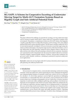
46 - RG-SAPF: A Scheme for Cooperative Escorting of Underwater
Moving Target by Multi-AUV Formation Systems Based on
Rigidity Graph and Safe Artificial Potential Field
Authors: Wen Pang, Daqi Zhu, Mingzhi Chen, & Wentao
Xu
This paper discusses how to escort a moving underwater
target, like a human-occupied vehicle, using multiple
autonomous underwater vehicles (AUVs) in difficult
ocean settings. It introduces the “Reward-Guided State-
Action Prediction and Filtering (RG-SAPF)” scheme for
formation control and path planning, ensuring effective
target escorting in complex environments.
