


Underwater mapping 2022


Authors:
Chensheng Cheng, Can Wang, Dianyu Yang, Weidong
Liu and Feihu Zhang.
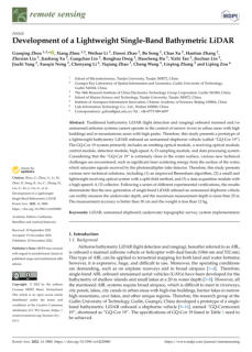
SLAM (Simultaneous Localization And Mapping) plays a
vital role in navigation tasks of AUV (Autonomous
Underwater Vehicle). However, due to a vast amount of
image sonar data and some acoustic equipment’s
inherent high latency, it is challenging to implement real-
time underwater SLAM on a small AUV. This paper
presents a filter based methodology for SLAM algorithms
in underwater environments.

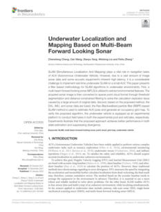

Authors:
Emir Cem Gezer, Lin Zhao, Jordan Beason, Mingxi Zhou.
Date of publication: 2022
Seafloor mapping and monitoring are essential for
creating a sustainable economy and widening our
understanding of the ocean environments. However, the
cost of conducting underwater operations has always
been high. This paper presents the progress on
developing an affordable Autonomous Under-water
Vehicle (AUV), equipped with an interferometric sonar for
seabed mapping at low altitudes or in coastal water.

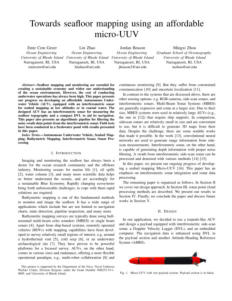

Authors:
Jinkun Wang, Fanfei Chen, Yewei Huang, John
McConnell, Tixiao Shan & Brendan Englot
Date of publication: 2022
This paper presents a novel exploration framework for
underwater robots operating in cluttered environments,
built upon simultaneous localization and mapping (SLAM)
with imaging sonar. The proposed system comprises path
generation, place recognition forecasting, belief
propagation, and utility evaluation using a virtual map,
which estimates the uncertainty associated with map cells
throughout a robot’s workspace.


Authors:
Balint Z. Teglasy Emil Wengle, John R. Potter, and Sokratis
Katsikas
Secure digital wireless communication underwater is a
crucial issue as the security of digital systems becomes
challenged across all domains.
The authors of this document address the requirements
for security, namely, a confirmation of asset identities, also
known as "authentication". They propose and validate an
authentication protocol based on the first digital
underwater communications standard primarily applicable
to AUVs operating around offshore oil and gas facilities
but also to other underwater devices.


Authors: Changho Yun
To efficiently utilize nonexclusive underwater acoustic
frequencies, The authors propose an Underwater
Cooperative Spectrum Sharing (UCSS) protocol for a
centralized underwater cognitive acoustic network
consisting mainly of two parts. In the first part, to check
the random occurrence of interferers periodically, the time
domain is divided into frames that consist of a sensing and
a non-sensing sub-frame. Then, they set the ratio of the
two sub-frames to enhance the sensing rate via
simulations.


Authors: Zheng Liu, Yaoming Zhuang, Pengrun Jia,
Chengdong Wu, Hongli Xu, and Zhanlin Liu.
The automatic detection and identification of marine
organisms are critical for aquaculture resources. However,
due to the low quality of underwater images and the
characteristics of underwater biological detection, the lack
of abundant features can impede traditional hand-
designed feature extraction approaches or CNN-based
object detection algorithms, particularly in complex
aquatic environments.
Therefore, this study aimed to perform object detection in
underwater environments.

Author: Serkan Aksoy
This document explains notions such as sonar equation,
acoustic waves, underwater acoustic equations,
reverberation, Helmholtz equation, noise sources,
cavitation, and target strength.


Author: Aslanbek Naziev
The authors study the (in)dependence of additivity and
homogeneity conditions in the definition of a linear
mapping between vector spaces over the same scalar
field. Unlike other works on this theme, which deal with
particular fields like real or complex numbers, we consider
the general case. That enables them to obtain an almost
complete picture.


Authors:
Tuochao Chen, Justin Chan, Shyamnath Gollakota
The authors present a novel underwater system that can
perform acoustic ranging between commodity
smartphones.
To achieve this, they design a real-time underwater
ranging protocol that computes the time-of-flight
between smartphones. To address the severe underwater
multipath, they present a dual-microphone optimization
algorithm that can more reliably identify the direct path.
Their evaluations show that our system has median errors
of 0.48–0.86 m at distances up to 35 m.

Authors:
Xiaotian Han, Peng Li, Chang Chang, Duorui Gao,
Dongquan Zhang, Peixuan Liao, Wei Wang, and
Xiaoping Xie
This document proposes solutions to the problems of
underwater wireless optical communication, which is
facing absorption and scattering problems.


Authors:
Zhimin Li, Zibin Lin, Longsheng Zeng, Hao Wu, and Xue-
Feng Zhu
Manipulating underwater acoustic waves along the
prescribed trajectory has excellent potential for various
applications. Traditional metasurfaces for underwater
acoustic modulation usually have complex structural
designs and are complicated to manufacture. Here, we
propose a simple strategy of embedding air bubbles of
different sizes inside the polymer to manipulate the
transmitted underwater acoustic wave fields freely.


Authors:
Xenophon Dimas, Elias Fakiris, Dimitris Christodoulou,
Nikos Georgiou, Maria Geraga, Vasillis Papathanasiou,
Sotiris Orfanidis, Spyros Kotomatas, and George
Papatheodorou
The aim of this study was to present the results of the first
complete marine habitat mapping through marine
remote sensing techniques in Gyaros Island, a remote
island in the Cyclades archipelago with a great historical
and ecological value


Author: Usman Ali, and Muhammad Tariq Mahmood
The authors of this paper propose a method for
underwater image restoration utilizing a technique that
incorporates the potential structural differences between
transmission maps and the guidance map.

Authors: Xu Liu, Sen Lin, Zhiyong Tao
Evidence suggests that vision is among the most critical
factors in marine information exploration. Instead,
underwater images are generally of poor quality due to
color casts, lack of texture details, and blurred edges. The
authors propose the Multiscale Gated Fusion conditional
GAN (MGF-cGAN) for underwater image enhancement.
The generator of MGF-cGAN consists of Multiscale
Feature Extract Module (Ms-FEM) and Gated Fusion
Module (GFM). In Ms-FEM, they use three parallel subnets
to extract feature information, which can extract richer
features than a single branch.

Authors:
Natalie Summers, Geir Johnsen, Aksel Mogstad, Håvard
Løvås, Glaucia Fragoso, Jørgen Berge
This document describes an Underwater Hyperspectral
Imager (UHI) deployed on an instrument-carrying
platform consisting of two interconnected mini-ROVs
(Remotely Operated Vehicle) for the mapping and
monitoring of Arctic macroalgal habitats in Kongsfjorden
(Svalbard) during the Polar Night.

Author: Hong-Gi Kim, Jungmin Seo, and Soo Mee Kim
Unmanned underwater operations using remotely
operated vehicles or unmanned surface vehicles are
increasing recently, guaranteeing human safety and work
efficiency. Optical cameras and multi-beam sonars are
generally utilized as imaging sensors in underwater
environments.
However, the obtained underwater images are difficult to
understand intuitively, owing to noise and distortion. This
study explains the development of an optical and sonar
image fusion system that integrates the color and distance
information from two images.


Authors: Zhenjing Zhu, Ning Hu, Junyi Wu, Wenxin Li,
Jiabao Zhao, Maofa Wang, Fanzong Zeng,
Huajie Dai, and Yongju Zheng.
This document presents a new method for estimating the
angular pulse spectrum. The process is based on the
Husimi transform of a wave field and can be realized
with a short vertical array of nondirectional hydrophones.
As a result, one obtains a diagram of the arrival pattern in
the time–angle plane. Special attention is paid to sound
scattering on a cold synoptic eddy along the waveguide.


Authors: Denis V. Makarov, and Leonid E. Konkov
This document presents a new method for estimating the
angular pulse spectrum. The process is based on the
Husimi transform of a wave field and can be realized with
a short vertical array of nondirectional hydrophones. As a
result, one obtains a diagram of the arrival pattern in the
time–angle plane. Special attention is paid to sound
scattering on a cold synoptic eddy along the waveguide.

Author: Yian Wang
An underwater target ranging and size measurement
system based on binocular vision is proposed to measure
the distance and size information of underwater targets
accurately. The underwater binocular calibration method
is used to obtain the underwater parameters of the
binocular camera, and the underwater images are
calibrated to make them coplanar and aligned.


Authors: Boris Gasparovic, Jonatan Lerga, Goran Mausa,
and Marina Ivasic-Kos
This paper addresses the challenges posed by underwater
conditions for image recognition and demonstrates the
use of various Convolutional Neural Network (CNN)
architectures, particularly focusing on the YOLO and
Faster RCNN models. It evaluates these models based on
detection accuracy, mean average precision, and
processing speed, highlighting the effectiveness of the
YOLOv4 model in achieving high accuracy and real-time
detection capabilities. It also positions this work as a
pioneering effort in the field of underwater pipeline
detection using deep learning.

Click on the
octopus to return to
the top of the page

Author: Yaofeng Xie, Zhibin Yu, Xiao Yu, & Bing Zheng
This article proposes a new underwater image
enhancement network designed to address the
challenges of enhancing images captured in low-light
underwater environments. It explains the limitations of
existing algorithms, the need for a specialized approach,
and the creation of a new dataset to train the proposed
model. It also highlights the effectiveness and robustness
of the new method through experimental results,
emphasizing its superior performance compared to
previous methods.

Authors: Nicholas F. L. Vale, Juan C. Braga, Alex C. Bastos,
Fernando C. Moraes, Claudia S. Karez, Ricardo G.
Bahia, Luis A. Leão, Renato C. Pereira, Gilberto M.
Amado-Filho, and Leonardo T. Salgado
This document presents a study on rhodolith beds located
on the Brazilian continental shelf, specifically off the
Sergipe-Alagoas Coast. It describes the characteristics,
distribution, and composition of these rhodolith beds, as
well as the methods used for their study, such as ROV
operations and bottom trawl sampling. It also provides
information on the age and growth phases of the
rhodoliths, highlighting their ecological significance and
the diversity of red algal morpho-taxa identified in the
area.

Authors: Kai Yan, Lanyue Liang, Ziqiang Zheng, Guoqing
Wang, Yang Yang
This text highlights the challenges of underwater visual
perception due to factors like low illumination and
suspended particles and critiques existing enhancement
methods for their poor performance. It proposes a new
approach that achieves better results with a simple and
lightweight network configuration, demonstrating its
effectiveness through experimental results. It also provides
a link to access the code for this method, indicating an
intent to share the research and facilitate further
exploration or use by others.

Authors: Larissa Macedo Cruz de Oliveira, Aaron Lim, Luis
A. Conti, and Andrew J. Wheeler
This document describes a study that explores the use of
machine learning methods combined with Structure-from-
Motion (SfM) photogrammetry for the classification of
cold-water coral (CWC) reefs in deep-water environments.
It outlines the challenges faced in this domain, such as the
lack of training data and benchmark datasets, and details
the methodology used in the study, including the
selection of the Piddington Mound area for data
collection, the machine learning algorithms employed,
and the evaluation of their performance.


29 - Present status and challenges of underwater acoustic target
recognition technology: A review.
Authors: Lei Zhufeng, Lei Xiaofang, Wang Na, and
Zhang Qingyang
This study covers the generation of underwater target
radiation noise and examines advancements in
recognition techniques using machine learning in three
areas: signal acquisition, feature extraction, and signal
recognition. It also discusses the challenges in this field
and proposes a new signal processing method that
combines traditional techniques with deep learning to
improve recognition rates and reduce computational
costs.

24 - Battery-free wireless imaging of underwater environments
Authors: Sayed Saad Afzal, Waleed Akbar, Osvy
Rodriguez, Mario Doumet, Unsoo Ha, Reza
Ghaffarivardavagh, & Fadel Adib
Underwater backscatter imaging is a scalable, real-time
wireless method for underwater environments, enabling
real-time observations of animals, plants, pollutants, and
localization tags. This self-sustaining method is suitable for
large, continuous deployments in oceans, with
applications including marine life discovery, submarine
surveillance, and underwater climate change monitoring.
Existing methods require tethering for power and
communication.
28 - Reinforcement Learning Based Mobile Underwater Localization
for Silent UUV in Underwater Acoustic Sensor Networks
Authors: Ruiheng Liao, Wei Su, Xiurong Wu, and En
Cheng
This paper proposes a reinforcement learning and neural
network-based mobile underwater localization scheme for
unmanned underwater vehicles (UUVs) to improve
localization accuracy and reduce energy consumption.
The scheme uses SqueezeNet to select line-of-sight
anchor nodes, while an RL-based approach selects
anchor nodes without the underwater environment
model. Simulation results show the proposed schemes
significantly improve localization accuracy and reduce
energy consumption.


Author: Eon-ho Lee, Byungjae Park, Myung-Hwan Jeon,
Hyesu Jang, Ayoung Kim, Sejin Lee
This paper discusses the challenges and solutions in object
recognition for underwater unmanned vessels, particularly
in regard to the limitations in obtaining experimental data.
It introduces an image transformation model, Pix2Pix, to
generate synthetic images that closely resemble real
experimental data collected by the ROV SPARUS. These
synthetic images are then used in conjunction with real
sonar images to train a pixel segmentation deep learning
model, FCN. The results indicate improved accuracy when
incorporating synthetic data, highlighting its potential to
alleviate the burdens of data preparation in underwater
environments.
27 - A node selection algorithm to graph-based multi-waypoint
optimization navigation and mapping
Authors: Timothy Sellers, Tingjun Lei, Chaomin Luo, Gene
Eu Jan, Junfeng Ma
This article discusses an innovative approach to
autonomous robot multi-waypoint navigation and
mapping, particularly for applications in search and
rescue, environmental exploration, and disaster response.
The proposed method utilizes an adjacent node selection
(ANS) algorithm alongside a generalized Voronoi diagram
(GVD) and an Improved Particle Swarm Optimization
(IPSO) algorithm. This combination is aimed at creating
safety-aware and efficient paths by bridging waypoints to
the nearest nodes or edges in a graph, while also
addressing obstacle avoidance through a sensor-based
local reactive navigator.

Authors: Dandi Wang, Shuai Xing, Yan He, Jiayong Yu,
Qing Xu, and Pengcheng
This study introduces and evaluates a lightweight, dual-
wavelength UAV-mounted airborne LiDAR bathymetry
(ALB) system for shallow water mapping, tested at
Dazhou Island, China. Using water surface points (fitted
planes) and multibeam echosounder data as references,
the system achieves decimeter-level precision: 0.1227 m
for water surface fitting and 0.1268 m absolute bottom
accuracy. It successfully identifies a 1m cube and resolves
the rough shape of a 2 m cube on the seafloor at 12 m
depth, demonstrating strong potential for flexible, high-
resolution shallow-water mapping and underwater object
detection.

Authors: Hongbo Yang, Zhizun Xu, and Baozhu Jia
Underwater positioning is challenging due to
electromagnetic wave attenuation, environmental
disturbances, and terrain complexity. Acoustic methods
suffer from low update rates, poor resolution, and noise
sensitivity, while vision-based approaches struggle with
sparse features, variable lighting, and light scattering. To
address these issues, this paper proposes a novel visual-
inertial-LiDAR system: a LiDAR camera provides robust
depth maps via laser scanning, and an inertial
measurement unit (IMU) supplies altitude data. Sensor
fusion enables UUV position prediction, refined further
using Bundle Adjustment to optimize rotation and
translation estimates.

Authors: Gang Yang, Zhaoshuo Tian, Zongjie Bi, Zihao
Cui, and Qingcao Liu
In underwater LiDAR imaging, the conventional constant
threshold adjacent frame difference (AFD) method loses
target distance information due to the Gaussian
distribution of laser light intensity, causing
inhomogeneous intensity in images acquired by intensity
charge-coupled devices (ICCD). To address this, the paper
proposes the novel dynamic threshold adjacent frame
difference (DTAFD) method, which adjusts the intensity
threshold according to pixel intensities across different
parts of a single frame ICCD image.
26 - LiDAR Intensity Completion: Fully Exploiting the Message from
LiDAR Sensors
Authors: Weichen Dai, Shenzhou Chen, Zhaoyang
Huang, Yan Xu, and Da Kong
LiDAR sensors provide illumination-robust depth and
intensity data via pulsed lasers, but their sparse, non-
camera-like intensity maps are underutilized. This work
introduces LiDAR-Net, an end-to-end CNN that jointly
completes sparse intensity and depth maps by leveraging
their correlation. A novel intensity fusion method
generates ground truth for training. Experiments show
intensity–depth fusion improves completion performance,
and downstream lane segmentation on completed
intensity maps retains ambient-light robustness, enabling
broader real-world LiDAR applications.

Authors:
Guoqing Zhou, Xiang Zhou, Weihao Li, Dawei Zhao, Bo
Song, Chao Xu, Haotian Zhang, Zhexian Liu, Jiasheng Xu,
Gangchao Lin, Ronghua Deng, Haocheng Hu, Yizhi Tan,
Jinchun Lin, Jiazhi Yang, Xueqin Nong, Chenyang Li,
Yiqiang Zhao, Cheng Wang, Lieping Zhang, & Liping Zou
This study introduces a lightweight bathymetry LiDAR
prototype mounted on an unmanned shipborne vehicle
to overcome limitations of traditional airborne LiDAR in
narrow urban rivers and mountainous areas. The system
includes key modules like emitting/receiving optics,
control, and high-speed data processing.