


Implement Photogrammetry in Commercial Diving
& ROV Operations: A Resource Guide (Page 1 of 3)
Photogrammetry is the science and technique of obtaining reliable
measurements and three-dimensional information about physical
objects and environments by compiling and analyzing multiple
photographs or digital images. This process creates detailed 3D models,
maps, and digital representations that can be explored interactively and
zoomed in to examine fine details from various perspectives.
This is achieved by capturing multiple overlapping images of an object
or scene from different angles, then analyzing them with software to
identify common points and, using triangulation, calculate the precise
positions of those points in 3D space. According to the paper "On
Laussedat's contribution to the emergence of photogrammetry" by L.
Polidori, the foundational principles of this technology trace back to the
mid-19th century, when French inventor Aimé Laussedat developed a
method for creating accurate topographic surveys he called
"metrophotography," using photographic images and specialized
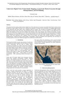
instruments he devised, and German Albrecht Meydenbauer, who
independently designed specialized cameras for measuring building
facades from photos during the same period.
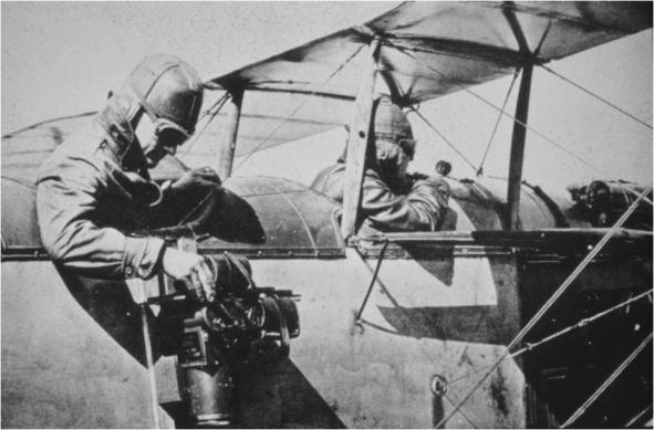
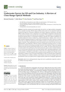
The idea was then adopted by geologists and militaries who further
developed it during the First and Second World Wars.


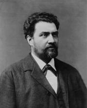
Albrecht Meydenbauer
Aimé Laussedat
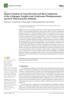
Aerial camera developed for spot and mapping shots during the 1st World War.
Photogrammetry transitioned to software-assisted processes in the
1960s with analytical methods using computers for calculations,
evolving into digital software by the 1980s-1990s that enabled
automated 3D model generation from images.
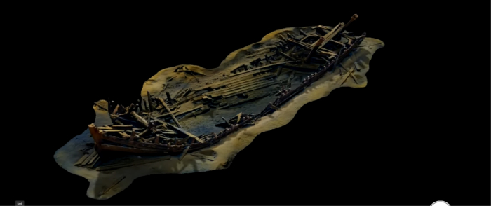
Underwater photogrammetry applies the principles outlined above and
has proven effective for representing submerged objects, structures,
or seafloor terrain that cannot be fully seen, since many targets lie in
darkness, and photographing underwater is challenged by
environmental constraints such as reduced visibility compared to air,
light absorption and scattering, refraction phenomena, turbidity, and the
need to protect cameras in specific housings, which compromise their
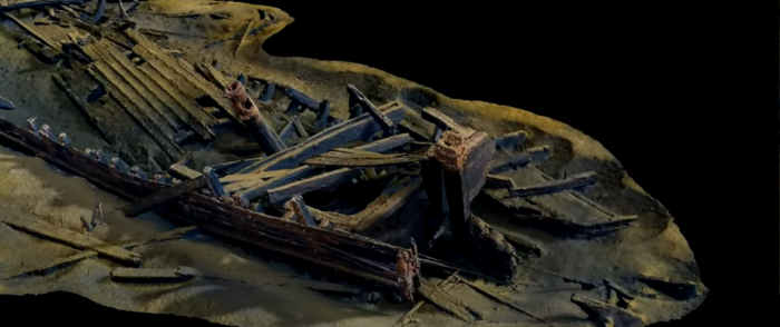
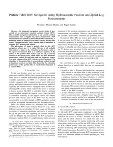
performance compared to air conditions. The slideshow below, from a
publicly released video by LA Survey AB, a company founded by Linus
Andersson and headquartered at Skogsviksvägen 52B, 423 61
Torslanda, Västra Götaland, Sweden (contact: linus@la-survey.se -
https://www.linkedin.com/company/la-survey-ab/), shows the
advantages this technology offers.
(Please click the picture to view the slideshow).
While archeologists commonly use this technology, it is still
underappreciated by most commercial diving and ROV companies,
despite its advantages, and that most companies possess the
equipment (high-resolution cameras, observation ROV, efficient
deployment systems, etc.), in addition to personnel accustomed to
performing inspections, to implement this technology quickly and
successfully. The only challenges are acquiring computers and
software, and adequately training the diving and ROV teams planned to
be involved. So, it could be implemented by following a road map, such
as the one below:
- Identify when this technology can be used.
- Identify the equipment needed.
- Identify the required training.
- Elaborate operating procedures.
- Implement the commercial approach.
As with the previous articles in this section, this presentation does not
provide implementation guidelines for this technology. Instead, it offers
resources and directories to help readers evaluate the technology's
advantages and potential markets, identify appropriate software, and
locate training providers. In other words:
- Articles and studies by system designers and users.
- A list of relevant digital applications.
- A directory of institutions providing training.
- A list of websites promoting photogrammetry.
- Videos and animations, including process presentations, project
showcases, and online courses.
Note that equipment such as cameras and ROVs is not covered here for
the reasons mentioned above.
While literature on photogrammetry was long kept confidential by
militaries and a few organizations, it began to grow exponentially with
the development of digital cameras, personal computers, and software
based on general-purpose operating systems (Windows, Linux,
macOS), making this technology accessible at reasonable costs.
The articles below belong to categories such as archeology,
environmental studies, visual inspection, and mapping. However,
because the implementation procedure is similar across work
categories, they have been classified chronologically from 2015 to the
end of 2025.


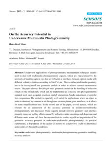
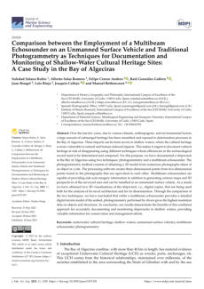
Author: Hans-Gerd Maas
This study explores the challenges of applying
photogrammetry underwater, particularly dealing with
the refraction of optical rays. It presents a geometric
model designed to manage refraction effects, which can
integrate into existing photogrammetric tools for
improving measurement accuracy. It also discusses various
factors affecting geometric accuracy in underwater
photogrammetry, highlighting significant performance
degradation due to refractive index variations and other
optical phenomena
02 - Underwater Photogrammetry and 3D Reconstruction of
Submerged Objects in Shallow Environments by ROV and
Underwater GPS
- Published by the Journal of marine science research & technology - Springer
Authors: Jonathan Teague, and Thomas B. Scott
This article discusses the emergence of underwater 3D
reconstruction techniques, particularly underwater
photogrammetry, as a cost-effective alternative to
traditional methods like Lidar and Sonar. Utilizing
affordable off-the-shelf digital cameras and software, this
technique proves advantageous in shallow water
settings. The article further explores the use of low-cost
remotely operated vehicles (ROVs) for conducting
underwater surveys, highlighting their speed and stability
over diver-based methods.
Articles and studies by system designers and users

03 - Photogrammetry under water: A tutorial for the first steps
in underwater-photogrammetry (version: 5.0)
- Published by Stichting Maritiem Onderzoek Nederland
Author: Hans van der Weide
This manual serves as a foundational guide for individuals
interested in underwater photogrammetry, highlighting
its novelty and the author’s personal journey of discovery
and experimentation in the field. The author aims to share
insights gained from practical experiences to assist
newcomers by preventing common mistakes. The tutorial
aspires to be a collaborative resource, welcoming user
feedback and updates to enhance its utility for all.

04 - Georeferenced underwater photogammetry to map marine
habitats and submeged artificial structures
- Published by the Photogrammetric Record / Wiley Online
Authors: Arnaud Abadie, Pierre Boissery, Christophe Viala
This article discusses recent advancements in underwater
photogrammetry, focusing on two innovative methods
that enhance geographic referencing through
underwater photography. The first method integrates
scuba diving with data from a multibeam echo sounder,
while the second employs a surface floating device for
direct positioning. The study concludes that the floating
platform method offers greater mapping efficiency despite
limitations related to depth and visibility. These
advancements are poised to significantly benefit marine
conservation efforts, particularly in monitoring seagrass
meadows and artificial underwater structures.

05 - Interpreting the Significance of Underwater Archaeological
Photogrammetry
- Published by the Honor Frost Foundation
Author: Persefoni Lesgidi
This article examines the role and effectiveness of
photogrammetry as a documentation method in cultural
heritage, specifically focusing on underwater applications.
By analyzing various articles and interactive platforms, it
highlights a case study of the Mazotos shipwreck to
explore how archaeologists utilize photogrammetry
underwater and underscores its significance in maritime
archaeology. Additionally, the article discusses the
challenges faced in underwater photogrammetry and
proposes potential solutions to address these limitations.
06 - Understanding underwater photogrammetry for maritime
archaeology through immersive virtual reality
- Published by The International Archives of the Photogrammetry
Authors: M. Dolezal, M. Vlachos, M. Secci, S. Demesticha,
D. Skarlatos, F. Liarokapis
This article explores the challenges and advancements in
underwater archaeology, particularly the use of
photogrammetry as a valuable tool for documenting
archaeological sites. It highlights the difficulties of working
underwater, the importance of proper preparation for
divers, and the development of educational software
using immersive virtual reality to teach maritime
archaeology students about photogrammetric
techniques. A user study evaluating the software indicates
its effectiveness in aiding understanding of underwater
photogrammetry basics.
07 - Impact of Stereo Camera Calibration to Object Accuracy in
Multimedia Photogrammetry
- Published by MDPI - Remote sensing
Authors: Oliver Kahmen, Robin Rofallski, and Thomas
Luhmann
The article examines the calibration strategies for planar
bundle-invariant interfaces in multimedia
photogrammetry, focusing on the effects of implicit
modeling of refractive interfaces during bundle
adjustment. By simulating error-free datasets, the research
investigates how interior, exterior, and relative orientation
parameters are influenced by these methods. Findings
indicate significant systematic effects under varying
conditions, emphasizing that implicit modeling may lead
to geometrical and positioning errors. The study
advocates for explicit modeling of refractive interfaces to
enhance calibration accuracy, supported by both
synthetic data analysis and real experimental results.


08 - Underwater Photogrammetry Application for Coral Reef
Mapping and Monitoring
- Published by the International Journal on advanced science Engineering information
technology
Authors: Agung Budi Cahyono, Andreas Catur Wibisono,
Dian Saptarini, Rizki Indra Permadi, Yanto
Budisusanto, Husnul Hidayat
This article presents a detailed exploration of underwater
mapping techniques, focusing on underwater
photogrammetry as a modern method for mapping coral
reefs. It discusses the use of a waterproof sport-fisheye
camera to capture images for 3D reconstruction,
highlighting the process from data acquisition to the
production of high-resolution coral reef photo maps. The
study demonstrates the effectiveness of using non-metric
cameras and the Structure from Motion (SfM) algorithm,
with specific parameters and results provided from the
research conducted on a designated coral reef area.
09 - Underwater Survey for Oil and Gas Industry: A Review of Close
Range Optical Methods
- Published by MDPI - Remote sensing
Authors: Bertrand Chemisky, Fabio Menna, Erica
Nocerino, and Pierre Drap
This paper discusses the growing demand for high-
resolution cartographic data in industrial and scientific
fields, particularly for managing aging offshore subsea
assets. It highlights the importance of inspection,
maintenance, and repair (IMR) in ensuring the longevity
and integrity of subsea structures. The review focuses on
optical sensor technologies, assessing their maturity, cost-
effectiveness, and implementation ease, as well as
addressing challenges related to data qualification and
limitations. It further explores the potential of integrating
acoustic and optical technologies to enhance
performance under low visibility conditions in underwater
mapping tasks.
10 - Underwater photogrammetry as an environmental assessment
tool to monitor coral reefs and artificial structures
- Published by Offshore Technology Conference
Authors: Vincent Mahamadaly, Isabel Urbina Barreto,
Louis Fréchon, Romain Pinel, Rémi Garnier,
Kenneth Deslarzes
This article discusses the significant growth of
photogrammetry over the past decade, particularly
emphasizing its application in underwater environments
for environmental monitoring, marine construction,
technical inspection, and archaeology. The study aims to
establish new underwater acquisition protocols and tools
for surveying marine resources, highlighting the
importance of 3D characteristics in various underwater
structures, specifically coral reefs and artificial
constructions.

11 - Underwater Photogrammetry Captures the Initial Recovery of a
Coral Reef at Lalo Atoll
- Published by MDPI - Diversity
Authors: Atsuko Fukunaga, Kailey H. Pascoe, Ashley R.
Pugh, Randall K. Kosaki, and John H. R. Burns
This document examines the recovery of a coral reef at
Lalo Atoll, which was devastated by Hurricane Walaka in
2018. Utilizing underwater photogrammetry, researchers
assessed the benthic cover and confirmed the
colonization of coral, macroalgae, and sponges. Despite
the reef being predominantly covered in rubble and sand,
the return of 35 reef fish species indicates positive
ecological signs. The study emphasizes the importance of
continuous monitoring to determine whether the reef will
revert to its original state dominated by Acropora coral or
develop a new coral composition.

12 - Editorial for Special Issue: Recent Developments in Multi-Media
and Underwater Photogrammetry
- Published by Springer nature
Authors: Hans-Gerd Maas, & Thomas Luhmann
This paper discusses the advances and challenges of
three-dimensional reconstruction using 3D imaging
methods like photogrammetry, computer vision, and laser
scanning, particularly in underwater environments. It
introduces the term multi-media photogrammetry in the
context of the optical complexities of water and highlights
new developments in sensor technologies, autonomous
systems, and machine learning. The article presents a
collection of contributions from experts addressing novel
sensor concepts, geometric modeling, and object
reconstruction, further enhancing the 2021 PFG special
issue on related technologies.
13 - Underwater 3D Scanning System for Cultural Heritage
Documentation
- Published by MDPI - Remote sensing
Authors: Christian Bräuer-Burchardt, Christoph Munkelt,
Michael Bleier, Matthias Heinze, Ingo Gebhart,
Peter Kühmstedt, and Gunther Notni
This article presents a novel 3D scanning system utilizing
structured illumination for the documentation of
underwater archaeological sites and shipwrecks. The
system, comprised of various components including
monochrome cameras and a projection unit, is designed
to facilitate accurate measurement and cultural heritage
documentation in underwater settings. The advantages
and limits of the new scanning technique are evaluated
against traditional methods like laser scanning and
photogrammetry. The article includes detailed discussions
on practical applications, operational scenarios, and the
measurement accuracy observed in real-world
underwater environments.

14 - Using UAVs and Photogrammetry in Bathymetric Surveys in
Shallow Waters
- Published by MDPI - Applied Sciences
Authors: Alexandre Almeida Del Savio, Ana Luna Torres,
Monica Alejandra Vergara Olivera, Sara Rocio
Llimpe Rojas, , Gianella Tania Urday Ibarra, and
Alcindo Neckel
This article discusses the use of unmanned aerial vehicles
(UAVs) and photogrammetry for conducting bathymetric
surveys with enhanced safety, cost-effectiveness, and
accuracy. The study evaluates error levels during UAV
flights over controlled water bodies at varying depths,
analyzing how turbidity and luminosity influences the
accuracy of these measurements. Key findings indicate
that higher luminosity correlates with lower errors up to a
depth of 0.97 m, while the effect of turbidity on error rates
varies based on depth, suggesting practical applications
for UAV-based photogrammetry in shallow waters.

15 - Photogrammetry, from the Land to the Sea and Beyond:
A Unifying Approach to Study Terrestrial and Marine
Environments
- Published by MDPI - Journal of Marine Science and Engineering
Authors: Torcuato Pulido Mantas, Camilla Roveta, Barbara
Calcinai, Cristina Gioia di Camillo, Chiara
Gambardella, Chiara Gregorin, Martina Coppari,
Teo Marrocco, Stefania Puce, Agnese Riccardi,
and Carlo Cerrano
This article chronicles the evolution of photogrammetry,
particularly focusing on the structure from motion (SfM)
technique that has gained popularity due to
technological advances over two decades. It highlights
the transition of this methodology from terrestrial settings
to underground and underwater surveys, noting that
recent affordable imaging systems have democratized
access to these techniques across various research fields
16 - Assessing Seagrass Restoration Actions through a
Micro-Bathymetry Survey Approach (Italy, Mediterranean Sea)
- Published by MDPI - Water
Authors: Sante Francesco Rende, Alessandro Bosman,
Fabio Menna, Antonio Lagudi, Fabio Bruno,
Umberto Severino, Monica Montefalcone,
Andrew D. Irving, Vincenzo Raimondi,
Sebastiano Calvo, Gerard Pergent, Christine
Pergent-Martini, and Agostino Tomasello
This article discusses the application of underwater
photogrammetry as a method to generate high-resolution
products, such as dense point clouds, 3D models, and
orthomosaics, essential for monitoring benthic
communities like seagrass beds. The study specifically
examines the efficacy of a photogrammetric approach in
assessing the restoration of Posidonia oceanica,
addressing the challenges of accuracy in 3D models for
surface and volume estimations.
18 - Comparison between the Employment of a Multibeam
Echosounder on an Unmanned Surface Vehicle and Traditional
Photogrammetry as Techniques for Documentation and
Monitoring of Shallow-Water Cultural Heritage Sites: A Case
Study in the Bay of Algeciras
- Published by MDPI - Journal of Marine Science and Engineering
Authors: Soledad Solana Rubio, Alberto Salas Romero,
Felipe Cerezo Andreo, Raúl González Gallero,
Juan Rengel, Luis Rioja, Joaquín Callejo, and
Manuel Bethencourt
The article discusses the urgent need to document
submerged cultural heritage in the Bay of Algeciras,
highlighting the risks posed by climatic and environmental
factors. It examines two different techniques:
photogrammetry and multibeam echosounding, used to
document a shipwreck, concluding that while each
method serves distinct purposes, their combination
enhances the accuracy of conservation and management
efforts.
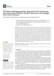
17 - An Enhanced Photogrammetric Approach for the Underwater
Surveying of the Posidonia Meadow Structure in the Spiaggia
Nera Area of Maratea
- Published by MDPI - Imaging
Authors: Francesca Russo, Silvio Del Pizzo, Fabiana Di
Ciaccio, and Salvatore Troisi
This paper discusses the significance of Posidonia
oceanica meadows as indicators of marine ecosystem
health and their role in coastal conservation. It outlines a
methodology for their effective monitoring and mapping
through underwater photogrammetry. The study
emphasizes the impact of environmental factors on image
quality and introduces two algorithms to enhance image
processing. This approach facilitates the creation of a 3D
point cloud that allows for improved categorization and
assessment of Posidonia coverage across larger areas.
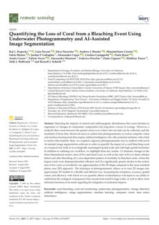
19 - Quantifying the Loss of Coral from a Bleaching Event Using
Underwater Photogrammetry and AI-Assisted Image
Segmentation
- Published by MDPI - Remote sensing
Authors: Kai L. Kopecky, Gaia Pavoni, Erica Nocerino,
Andrew J. Brooks, Massimiliano Corsini, Fabio
Menna, Jordan P. Gallagher, Alessandro Capra,
Cristina Castagnetti, Paolo Rossi, Armin Gruen,
Fabian Neyer, Alessandro Muntoni, Federico
Ponchio, Paolo Cignoni, Matthias Troyer, Sally J.
Holbrook, and Russell J. Schmitt
This article discusses the integration of underwater
photogrammetry and artificial intelligence (AI) to assess
the effects of coral bleaching on tropical reefs. By
combining a detailed photogrammetric survey with AI-
assisted image segmentation, researchers were able to
analyze significant changes in coral communities both
spatially and in detail.

20 - Quick bathymetry mapping of a Roman archaeological site
using RTK UAS-based photogrammetry
- Published by Frontiers
Authors: Davide Mazza, Luigi Parente, Daniele Cifaldi,
Agostino Meo, Maria Rosaria Senatore,
Francesco Maria Guadagno, and Paola Revellino
This article discusses the use of drone-based Structure-
from-Motion (SfM) photogrammetry in geoscientific
research, particularly for surveying underwater
archaeological sites. Conducted as part of the
GeoArchaeo Sites Project, the study compares the
performance of two drones, the Phantom 4 RTK and the
budget-friendly Mavic Mini 2, alongside an underwater
camera, to assess their ability to produce high-resolution
topographic models and bathymetric data in shallow
waters. The findings highlight the potential of these
technologies to effectively define submerged topography

21 - Workshop on 3D mapping of habitats and biological
communities with underwater photogrammetry
- Published by Research Ideas and Outcomes (RIO)
Authors: Loïc Van Audenhaege, Vincent Mahamadaly,
David Price, Alexandre Sneessens, Hayley C.
Cawthra, Clément Delamare, Valentin Danet,
Simon Delsol, Rodolphe Devillers, Iason-Zois
Gazis, Isabel Urbina-Barreto
This paper discusses the growing use of photogrammetry
for monitoring underwater structures and its
development as a data collection method in aquatic
environments. It highlights a workshop organized at the
annual GeoHab conference aimed at addressing the
audience’s lack of knowledge in photogrammetry. The
workshop included theoretical concepts, sampling
designs, practical case studies, and hands-on training in
data acquisition and processing.

22 - Low-Tech and Low-Cost System for High-Resolution
Underwater RTK Photogrammetry in Coastal Shallow Waters
- Published by MDPI - Remote sensing
Authors: Marion Jaud, Simon Delsol, Isabel Urbina-Barreto
, Emmanuel Augereau, Emmanuel Cordier,
François Guilhaumon, Nicolas Le Dantec, France
Floc’h, and Christophe Delacourt
This study presents a novel, low-cost system named
POSEIDON, which utilizes Structure-from-Motion (SfM)
photogrammetry to create high-resolution 3D models of
the seabed. With a cost of approximately USD 1500, this
adaptable prototype includes floating support, imagery
sensors, and a precise positioning system. Validation of
POSEIDON’s methodology reveals a mean deviation of
5.2 cm compared to traditional terrestrial surveys,
highlighting its potential applications in various scientific
and technical fields.
23 - Potentialities of the combined use of underwater fluorescence
imagery and photogrammetry for the detection of fi ne-scale
changes in marine bioconstructors
- Published by Frontiers
Authors: Cristina Castagnetti, Paolo Rossi, Sara Righi,
Stefano Cattini, Roberto Simonini, Luigi Rovati,
and Alessandro Capra
This paper explores the principles and methodologies of
underwater photogrammetry, highlighting its
applications, particularly in geological and ecological
contexts. It emphasizes the significance of recent
technological advancements, especially in drone-based
Structure-from-Motion (SfM) photogrammetry, for creating
detailed 3D models and conducting effective underwater
surveying. The study evaluates the performance of
different drones and an underwater camera for capturing
high-resolution data in shallow waters, demonstrating the
feasibility and advantages of these methods in various
underwater environments.

24 - Underwater Cultural Heritage Documentation Using
Photogrammetry
- Published by MDPI - Journal of Marine Science and Engineering
Authors: Alessio Calantropio, and Filiberto Chiabrando
This article discusses the importance of underwater
cultural heritage (UCH) as an invaluable resource that
necessitates careful documentation and preservation. It
emphasizes the role of modern technologies, particularly
underwater photogrammetry, in producing high-
resolution models and monitoring the condition of UCH.
However, the article also highlights the various challenges
faced by these documentation techniques due to
environmental factors and optical properties of water,
while reviewing recent advancements and identifying
gaps in current methodologies.
25 - Recording the SS Thistlegorm: Rapid Multi-Image Underwater
Photogrammetric Survey of a Large Second World War Wreck
- Published by MDPI - Journal of Marine Science and Engineering
Authors: Simon Brown, and Jon C. Henderson
This paper outlines a methodical approach to surveying
and monitoring the SS Thistlegorm, a significant metal
wreck in the Red Sea, using digital photogrammetry with
a straightforward single-camera setup.
The study emphasizes a cost-effective and replicable
means for change monitoring in shipwrecks that complies
with professional standards and invites participation from
non-specialists in data collection. Key components include
an in-depth description of the SS Thistlegorm, equipment
utilized, surveys performed in 2017 and 2022, the
necessity of an organized data management system,
accuracy testing of collected data, and a detailed post-
processing workflow.

26 - Georeferencing Strategies in Very Shallow Waters: A Novel GCPs
Survey Approach for UCH Photogrammetric Documentation
- Published by DPI - Remote sensing
Authors: Alessio Calantropio, and Filiberto Chiabrando
This article discusses the growing interest in high-
resolution monitoring of underwater assets due to
demands for accuracy in surveying archaeological and
cultural heritage. It highlights the challenges of achieving
precise positioning and georeferencing underwater
compared to terrestrial methods. The paper explores the
use of innovative techniques and prototypes, including a
plastic marker and aluminum pole, designed for
topographic surveys in shallow waters. These prototypes
are coupled with a tilt-compensating smart antenna to
enhance measurement accuracy and independence from
shore-based equipment.
27 - Quantitative Evaluation of Color Enhancement Methods for
Underwater Photogrammetry in Very Shallow Water: a Case
Study
- Published by The International Society for Photogrammetry and Remote Sensing
Authors: Alessio Calantropio, Filiberto Chiabrando, Fabio
Menna, Erica Nocerino
This document explores the challenges of achieving
accurate color representation in underwater
photogrammetry due to factors like chromatic aberration
and light scattering. It evaluates various color
enhancement methods, including gray-world assumption
techniques, physical light property considerations, and
artificial intelligence approaches, and applies these
methods to images of a Roman shipwreck situated in the
Porto Cesareo Marine Protected Area, providing a
comparative analysis of their effectiveness in restoring
natural colors and enhancing image clarity.
28 - POSER: an open source Simulation platform for teaching and
training underwater photogrammetry
- Published by The International Society for Photogrammetry and Remote Sensing
Authors: Fabio Menna, Scott McAvoy, Erica Nocerino,
Beatrice Tanduo, Louise Giuseffi, Alessio
Calantropio, Filiberto Chiabrando, Lorenzo
Teppati Lose, Andrea Maria Lingua, Stuart
Sandin, Clint Edwards, Brian Zgliczynski,
Dominique Rissolo, Falko Kuester
This paper discusses the challenges of underwater
photogrammetry and the need for proper training for
underwater surveying professionals. It introduces POSER,
a 3D simulation framework built on Blender (open source
freeware), aimed at educating users about underwater
imaging principles. The framework incorporates realistic
water physics to enhance learning experiences through
practical scenarios relevant to various fields, including
marine ecology, archaeology, and subsea metrology.
29 - Photogrammetry of the Deep Seafloor from Archived
Unmanned Submersible Exploration Dives
- Published by MDPI - Journal of Marine Science and Engineering
Authors: Claudia H. Flores, and Uri S. ten Brink
This article presents a workflow for utilizing modern
photogrammetry techniques to construct extensive virtual
geological outcrops from archived video images collected
at deep-sea depths (over 1000 meters). Traditionally, the
analysis of these images has required significant effort for
individual reviews or small mosaics. The proposed
workflow addresses the challenges of non-linear
submersible paths, poor navigation, variable lighting, and
camera orientation, enabling quantitative measurements
that were previously unattainable. This method offers a
cost-effective means to analyze deep-sea geological
environments through existing video data, especially
when integrated with rock sample analysis

Authors: Veselina Gospodinova & Alexander Kirov
This paper examines underwater photogrammetry,
detailing its nature, principles, and methodologies for data
capture and processing. It provides a current snapshot of
its applications, including how divers and researchers can
leverage this technology to enhance their professional
skills and contribute valuable data to various scientific
fields. Additionally, it discusses the potential benefits for
recreational divers, professional divers, diving instructors,
and diving associations in adopting and promoting
underwater photogrammetry.
31 - A Novel Platform and Workflow for Underwater
Photogrammetry Surveys
- Published by The International Society for Photogrammetry and Remote Sensing
Authors: Alaa Mufti, Petra Helmholz, David Belton, Amir
Allahvirdi-Zadeh, and Iain Parnum
This article extensively outlines the advantages of
underwater photogrammetry over traditional
echosounder surveys, particularly in terms of cost-
effectiveness and data richness. The study highlights the
critical roles played by various sensors in ensuring
accuracy and quality while emphasizing the essential
need for reliable camera calibration in achieving precise
3D reconstructions. Overall, the research sets a promising
precedent for future innovations in marine mapping,
showcasing the potential for improved practices derived
from emerging technologies and methodologies.
32 - Bridging Disciplines with Photogrammetry: A Coastal Exploration
Approach for 3D Mapping and Underwater Positioning
- Published by MDPI - Remote sensing
Authors: Ali Alakbar Karaki, Ilaria Ferrando, Bianca Federici,
and Domenico Sguerso
This study discusses a novel methodology designed to
improve the accuracy of positioning underwater habitats
and understanding the interactions between terrestrial
and aquatic environments. By integrating UAV
photogrammetry and snorkeler-based underwater
photogrammetry, this approach utilizes image processing
tools to identify snorkeler positions instead of relying on
GNSS. The result is a georeferenced 3D model that
effectively combines land and underwater elements,
providing a valuable resource for coastal management
and enhancing coastal resilience.

33 - Enhancing Three-Dimensional Reconstruction Through
Intelligent Colormap Selection
- Published by MDPI - sensors
Authors: Alexandros Vrochidis, Dimitrios Tzovaras, and
Stelios Krinidis
This article presents a novel photogrammetry method that
significantly improves three-dimensional (3D)
reconstructions by enhancing image quality using RGB
stretching, Contrast Limited Adaptive Histogram
Equalization (CLAHE), and optimized colormaps. The
methodology increases the number of keypoints and
matches between images, resulting in improved
reconstruction accuracy. A heuristic approach is
introduced to identify optimal colormaps, facilitating time-
saving recommendations for various datasets. The
algorithm is validated using a new dataset of underwater
cultural heritage images, particularly in challenging low-
visibility environments.
34 - Spatial Variation in Coral Diversity and Reef Complexity in the
Galápagos: Insights from Underwater photogrammetry and
New Data Extraction Methods
- Published by MDPI - Remote sensing
Authors: Matan Yuval, Franklin Teran, Wilson Iniguez,
William Bensted-Smith, and Inti Keith
This article explores the diverse coral reef configurations in
the Galápagos Islands and highlights the impact of
disturbances such as El Niño and mass bleaching on
these ecosystems. Traditional ecological methods have
struggled to adequately capture coral demographic
trends over large areas, which is why the study employs
advanced photogrammetry techniques for underwater
surveys. By developing new methods for 3D annotation
and fractal dimension calculation, the researchers were
able to reveal important variations in coral cover, diversity,
and structural complexity. Their findings contribute
valuable data to a new dataset, Galápagos_3D, that aims
to support long-term monitoring and conservation efforts.
35 - Underwater Heritage documentation using photogrammetry:
the CRAB system
- Published by the International Journal on Advanced Science Engineering Information
Technology
Authors: Beatrice Tanduo, Edward Borgogno, Filiberto
Chiabrando, Francesca Gallitto, Stefania Manca,
Paolo Maschio, Andrea Lingua
This article discusses the challenges of documenting and
preserving submerged cultural heritage due to
environmental factors. It introduces the CRAB (Calibrated
Rig for Aquatic photogrammetric Bicamera system), a
sophisticated imaging system designed for high-resolution
3D reconstruction of underwater archaeological sites.
Tested at a Roman shipwreck in Italy, CRAB utilizes
synchronized high-resolution cameras and a structured
image acquisition pattern, resulting in an effective method
for underwater photogrammetry that enhances the
documentation and conservation of submerged cultural
assets.
36 - Multiscale structural complexity assessment of coral reefs using
underwater photogrammetry
- Published by Plos One
Authors: Erick Barrera-Falcón, Rodolfo Rioja-Nieto, Roberto
C. Hernández-Landa
This article explores the structural complexity of coral reefs,
emphasizing the need to assess their condition,
biodiversity, and resilience through advanced methods. It
critiques traditional rugosity indices for neglecting the
underlying features of reefs and presents a wavelet-based
method utilizing digital underwater photogrammetry for
comprehensive multiscale analysis. This method considers
both surface and underlying coral characteristics,
revealing significant insights into reef complexity and the
predominance of certain coral types in driving structural
diversity.

37 - Underwater Digital Twin of Yuba Island: Mapping a Large-Scale
Marine Ecosystem through Photogrammetry and 3D Modeling
- Published by the International Journal on Advanced Science Engineering Information
Technology
Author: Christoph Gerigk
The project described in this paper aimed to construct a
detailed digital twin of the underwater environment
surrounding Yuba Island in the Red Sea, Saudi Arabia,
mimicking the diving experience through precise 3D
mapping of both underwater and above-water
landscapes. Completed in six months, the model includes
accurately rendered textures and colors, with a depth
accuracy of ±0.10 m. It encompasses a diverse marine
ecosystem, documenting over 100 local fish species, and
culminates in various digital deliverables, including VR
experiences and software applications.
38 - Underwater Mapping in Shallow Coastal Waters Using MBES
and Photogrammetry: Applications in Archaeology and Marine
Habitat Monitoring
- Published by the International Journal on Advanced Science Engineering Information
Technology
Authors: Saso Poglajen, & Mojca Poklar
This study investigates the synergistic use of Multibeam
Echosounder (MBES) and Structure-from-Motion (SfM)
photogrammetry to enhance underwater mapping in
shallow coastal environments, particularly within
Slovenian waters. The research includes two case studies:
mapping Posidonia oceanica seagrass meadows and
analyzing the submerged archaeological site of Fizine.
The integration of MBES’s spatial precision with the visual
detail provided by SfM improves habitat classification and
documentation of underwater features by capturing both
broad structures and intricate details.

39 - Application and Challenges of Photogrammetry in Underwater
Excavations: Case Studies from the Jeju Sinchang-ri and Gunsan
Seonyudo Sites, Korea
- Published by the International Journal on Advanced Science Engineering Information
Technology
Author: Jeong Heon
This paper explores the challenges and applications of
photogrammetry in underwater archaeology, particularly
in two sites in Korea: Jeju Sinchang-ri and Gunsan
Seonyudo. At Sinchang-ri, conditions allowed for high-
resolution site mapping using effective surveying
methods, while at Seonyudo, issues like sedimentation
forced the use of experimental techniques to capture
stratigraphy and artifact mapping. The study emphasizes
the necessity of adapting photogrammetric methods to
varying underwater environments to enhance
archaeological documentation.

40 - Bridging Photogrammetry and GIS Through Workflow
Automation: A Scalable Approach for Spatially-Linked 3D Data in
Underwater Cultural Heritage
- Published by the International Journal on Advanced Science Engineering Information
Technology
Authors: Julien Fortin, Sam Meacham, Dominique Rissolo,
Andreas Rosland, Wetherbee Dorshow
This article discusses the development of an automated
photogrammetry workflow that enhances the efficiency
and quality of data processing in digital heritage and
scientific research. By leveraging pre-defined processes
and AI-generated scripts, the automated system
streamlines image-to-model conversion and integrates
seamlessly with Geographic Information Systems (GIS).
This innovation not only reduces processing time and
improves data accessibility but also lowers the technical
barriers for non-specialists, fostering inclusivity in 3D
modeling and spatial analysis.
41 - Documenting Change on the SS Thistlegorm, Red Sea, Egypt:
Using Underwater Photogrammetry to Record Natural
Deterioration and Human Impacts on a World War II Shipwreck
- Published by MDPI - Heritage
Authors: Simon Brown, and Jon C. Henderson
The SS Thistlegorm, a British cargo ship sunk in 1941, has
become a popular dive site, leading to increased
deterioration and loss of artefacts due to environmental
and human impacts. The Thistlegorm Project conducted
detailed underwater surveys in 2017 and 2022,
establishing a baseline for monitoring the wreck’s
condition. The findings highlighted notable changes to
the wreck and its surroundings, emphasizing the
importance of photogrammetry in documentation and
conservation efforts. This approach not only aids in
preserving underwater cultural heritage but also sets a
precedent for managing heritage sites frequented by
divers.
42 - Correction of Refraction Effects on Unmanned Aerial Vehicle
Structure-from-Motion Bathymetric Survey for Coral Reef
Roughness Characterisation
- Published by MDPI - Remote sensing
Authors: Marion Jaud, Mila Geindre, Stéphane Bertin,
Yoan Benoit, Emmanuel Cordier, France Floc’h,
Emmanuel Augereau, and Kévin Martins
This document compares two methods for obtaining
high-resolution bathymetric data: underwater structure-
from-motion (SfM) photogrammetry and unmanned aerial
vehicle (UAV)-based SfM photogrammetry. While
underwater techniques minimize refraction distortions but
limit area coverage, UAV methods can cover larger areas
but require refraction correction. The study finds that
applying analytical and empirical correction methods
improves the accuracy of depth measurements
significantly, with specific emphasis on utilizing linear
regression for optimal seabed roughness estimation.
Continued on the next page.


Click on the
octopus to return to
the top of the page